Maps created by TCEQ GIS Staff
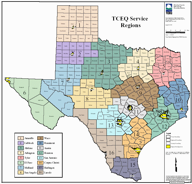
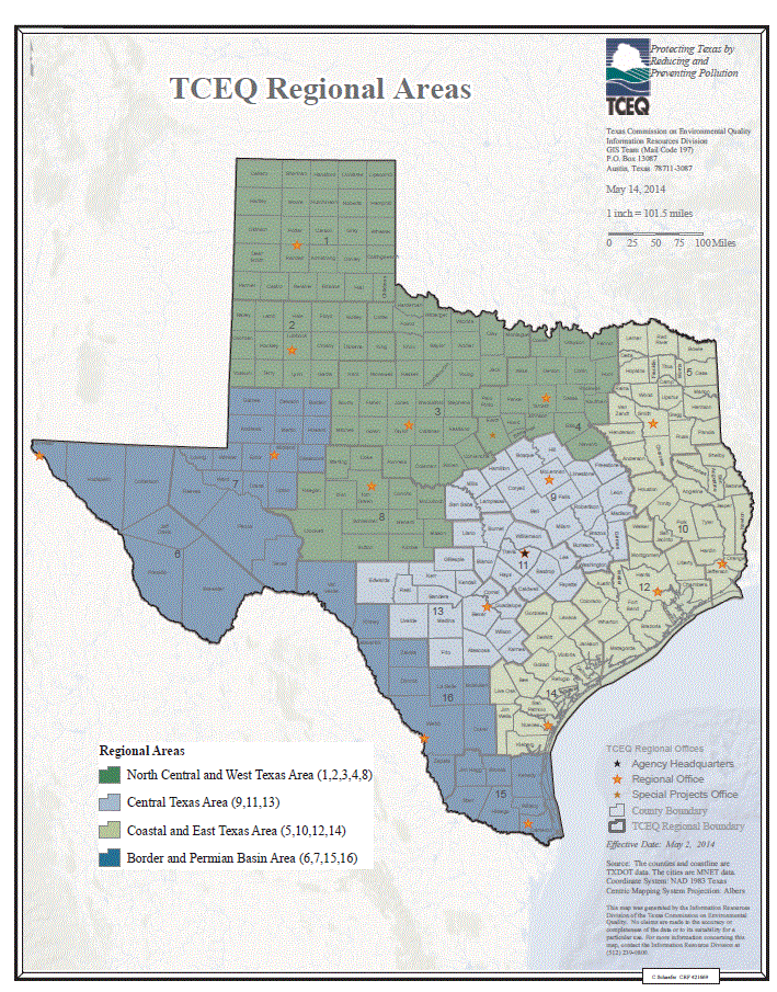
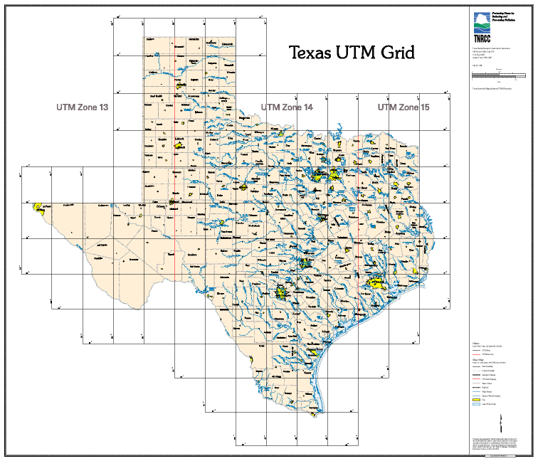
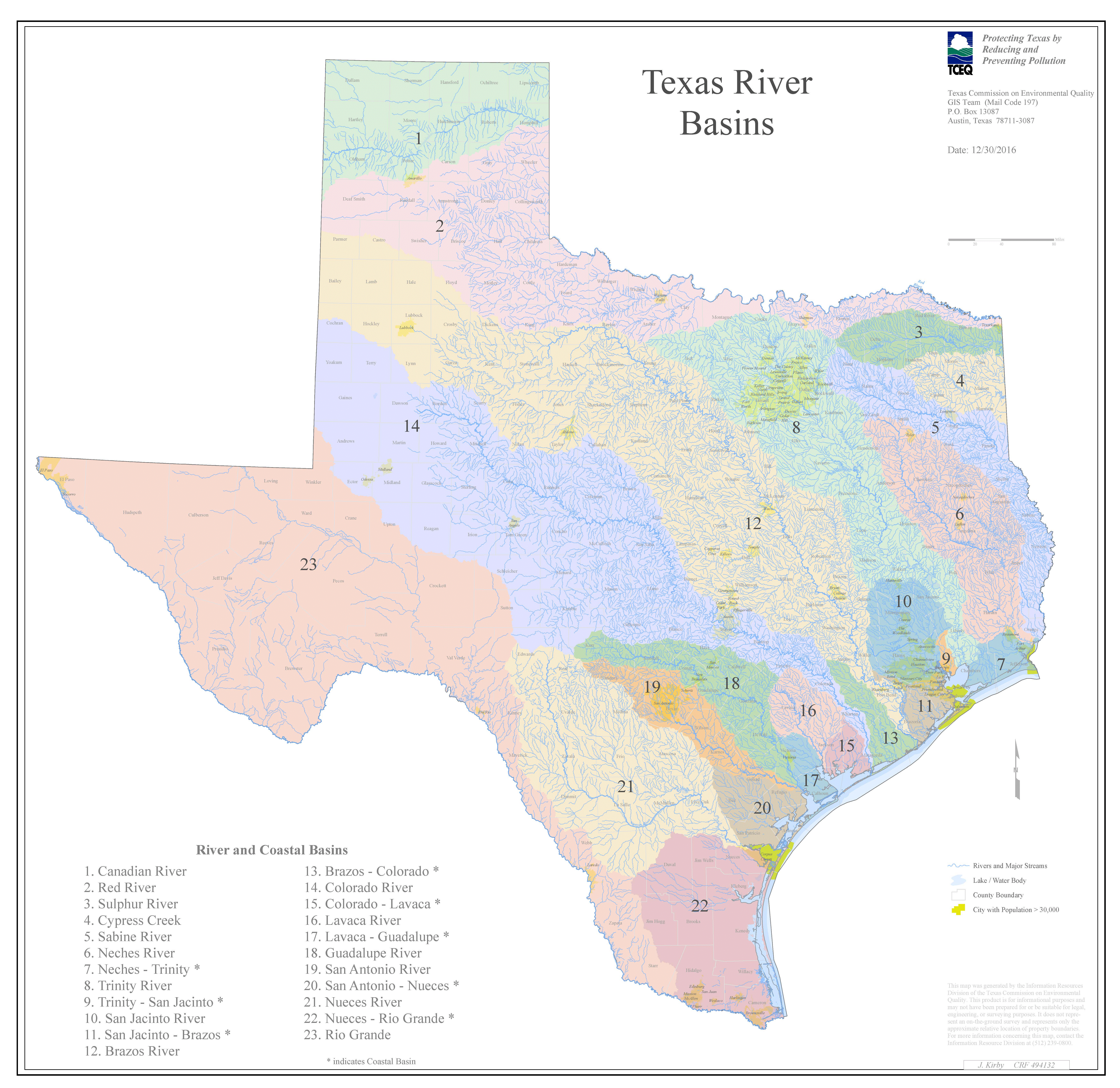
Contains various downloadable maps created at TCEQ, including TCEQ regions, stream segments, river basins, nonattainment areas, and more.
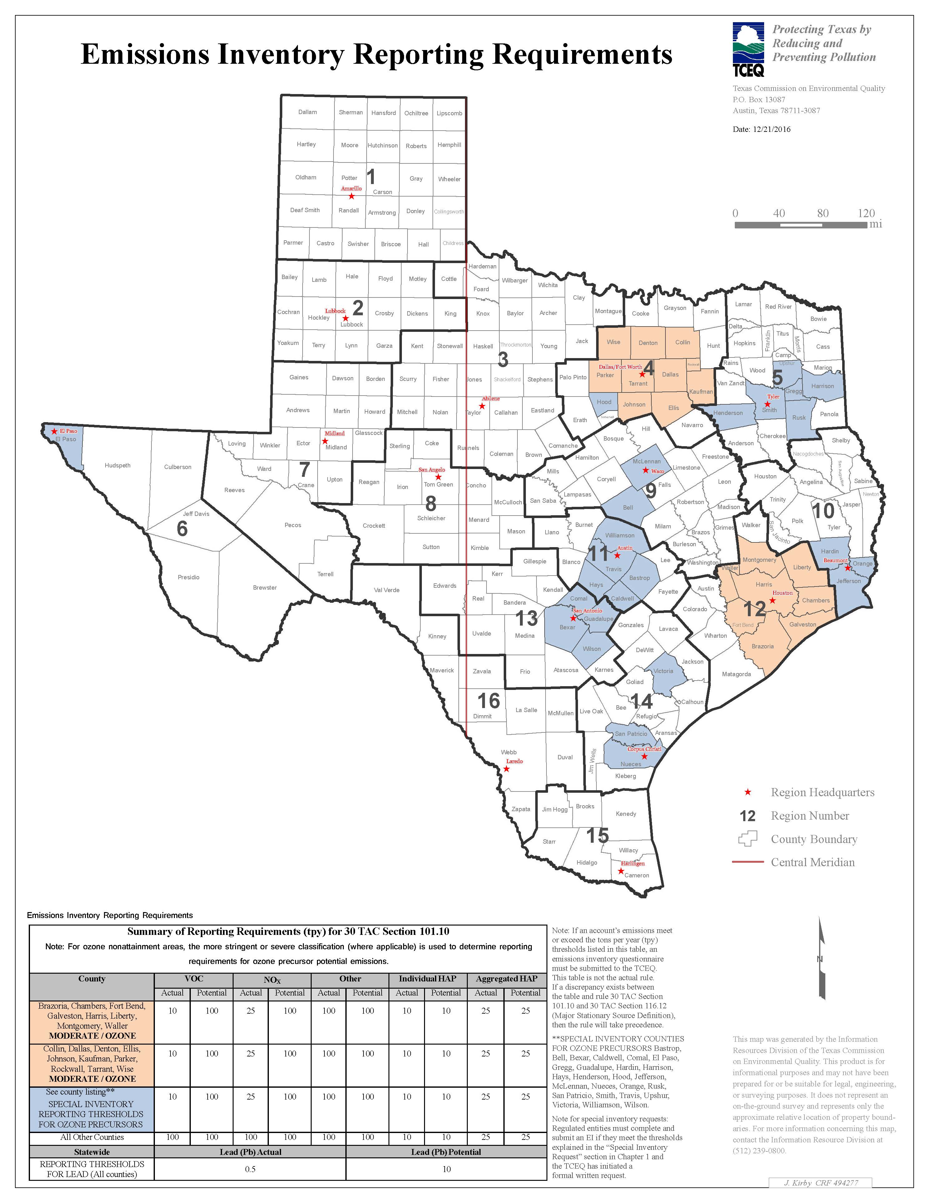
The following maps are downloadable in Encapsulated PostScript (EPS) and Adobe Portable Document Format (PDF). Click on the image to view a larger version of the map. Click the links on the right to download the appropriate file.
- Adobe Acrobat File (.PDF) format
- 35 x 35 in. - Adobe Acrobat File (.PDF) format
- 8.5 x 11 in. - Download Individual Region Maps
Click map to access individual region maps.
- Adobe Acrobat File (.PDF)
- 8.5 x 11 in.
- Adobe Acrobat File (.PDF) format
- 35 x 35 in.
Eight-Hour Ozone Nonattainment Areas
- Adobe Acrobat File (.PDF) format
- 8.5 x 11 in.


