Galveston Bay System
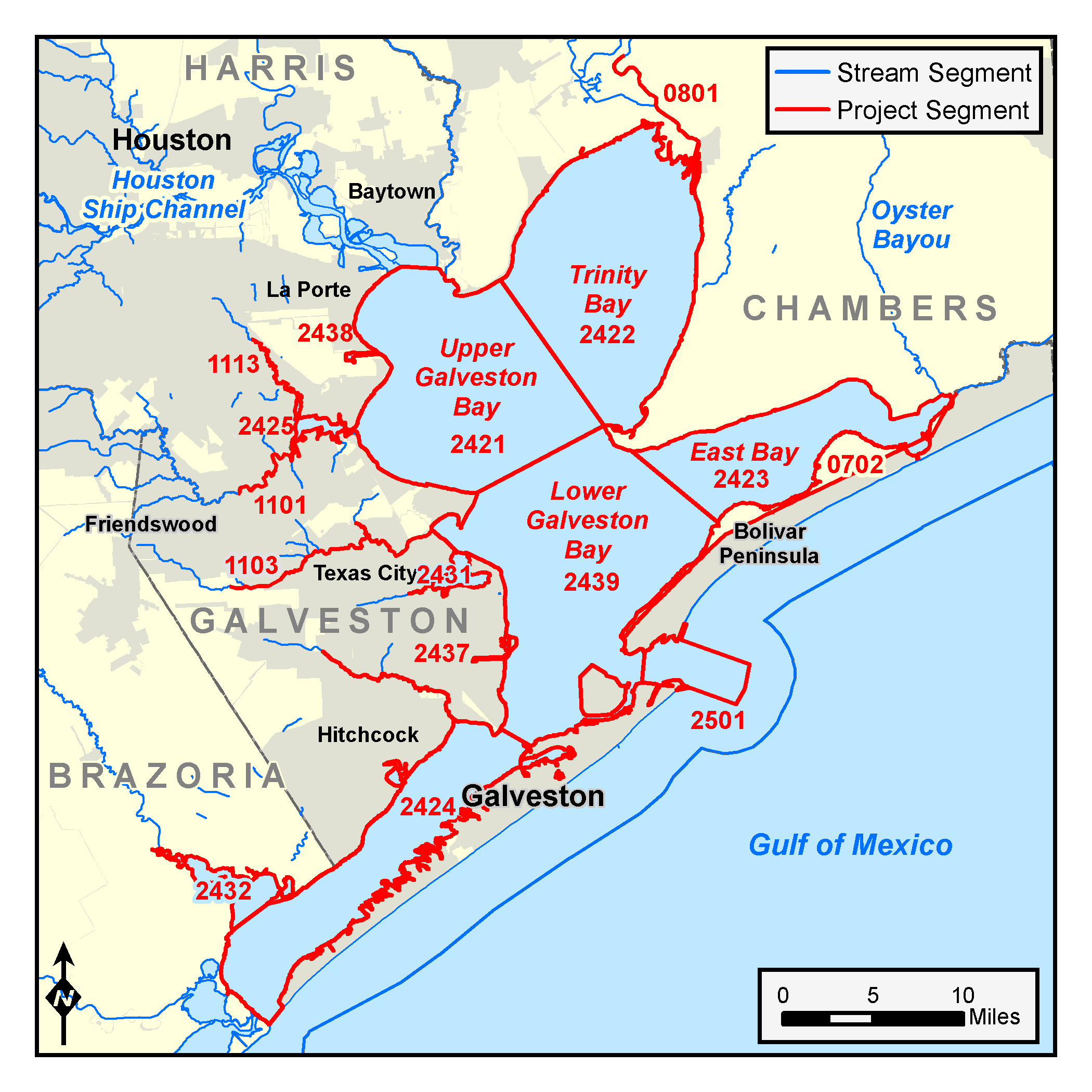

Counties: Brazoria, Calhoun, Chambers, Galveston, Harris, Jackson, Matagorda, Refugio, San Patricio, Victoria
Parameters: Dioxin and PCBs
Basins: Bays and Estuaries, Neches-Trinity Coastal, Trinity River, Trinity–San Jacinto Coastal, San Jacinto River, San Jacinto–Brazos Coastal
Segments: 0702, 0801, 1101, 1103, 1113, 2421, 2422, 2423, 2424, 2425, 2431, 2432, 2437, 2438, 2439, 2501
On this page:
Background and Goals
High concentrations of dioxin (PCDDs) and polychlorinated biphenyls (PCBs) in fish tissue pose a risk to consumers. Both dioxin and polychlorinated biphenyls (PCBs) are extremely persistent in the environment. Exposure to dioxin can cause a variety of harmful health problems, including cancer, birth defects, diabetes, developmental delays, and immune system abnormalities. While PCBs are much less toxic than dioxin, they were once produced in quantity and the net health effects are similar.
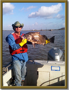
In July 2008, the Texas Department of State Health Services (DSHS) advised people not to eat catfish species or spotted sea trout from the Galveston Bay system, including Chocolate Bay, East Bay, West Bay, Trinity Bay, and contiguous waters. The advisory was issued due to dioxin and PCBs found in fish tissue. See more information in Advisory 49 on the DSHS web site .
This survey project collected and assessed data to determine the distribution of PCBs and dioxins throughout the bay system. Learn more about water quality standards, monitoring, and TMDLs by reading Preserving and Improving Water Quality.
Watershed Description
The Galveston Bay system supports commercial navigation that is important to the surrounding region and was a reason for the historic growth of the Houston-Galveston area economy. The bay system and its headwater reaches, tributaries, and fringes provide recreational opportunities and support sport fisheries that are economically important to residents.
The watershed includes portions of these political jurisdictions:
- Counties: Brazoria, Chambers, Fort Bend, Galveston, Harris
- Cities: Houston, Pasadena, Baytown, La Porte, Deer Park, Texas City, Galveston, and numerous other communities
Texas Department of State Health Services has issued advisories against eating fish from Galveston, Chocolate, East, and West bays and contiguous waters. Another advisory against eating spotted sea trout covers Houston Ship Channel downstream of the Lynchburg Ferry crossing and all its contiguous waters, which include Upper Galveston Bay north of a line drawn from Red Bluff Point to Five Mile Cut Marker to Houston Point.
Get Involved
The Houston-Galveston Area Council coordinated public participation activities for this project in conjunction with two related projects for dioxin and PCBs in their area. Due to the lengthy and extremely technical nature of this project, the TCEQ convened a standing stakeholder group to work on this and two other closely related projects for PCBs and dioxin in the Houston–Galveston area. The group included area residents and representatives of nongovernmental organizations, industry, and various local, state, and federal governments.
The H-GAC also coordinated participation, as needed, with the Texas Clean Rivers Program Steering Committee and the Technical Advisory Group (TAG) for the San Jacinto River Basin and associated coastal basins.
See more about the two related projects for Houston Ship Channel Dioxin and the Houston Ship Channel PCBs.
Contact the TMDL Program
Please e-mail the TMDL program and put “Galveston Bay System dioxin and PCBs survey” in the subject line. Or call us at 512-239-6682.