Lavaca River Above Tidal and Rocky Creek
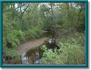
Photo Courtesy of the Texas Water Resources Institute


Counties: Lavaca, Jackson
Parameter: Bacteria
River Basin: Lavaca
Segment: 1602, 1602B
On this page:
- Background and Goals
- Watershed Description
- Get Involved
- Approved I-Plan
- Adopted TMDLs
- Reports
- Contact the TMDL Program
Background and Goals
High concentrations of bacteria, which are found in both human and animal waste, have been observed in the Lavaca River Above Tidal since 2008 and Rocky Creek since 2014. The presence of these bacteria may indicate a health risk to people who swim or wade in the water bodies—activities referred to as “contact recreation” in the Texas Surface Water Quality Standards.
In response to these conditions, people who have a stake in the watershed worked with TCEQ to develop a total maximum daily load (TMDL) and a plan to implement it. A TMDL is like a budget—it determines the amount (or load) of bacteria that the creek can receive and still support safe recreation. The allowable load is then allocated among categories of sources within the watershed. The implementation plan (I-Plan) outlines the measures that will be used to reduce pollution.
The goal of this project is to improve water quality in order to protect recreational uses.
Watershed Description
The Lavaca River Above Tidal (Segment 1602) and Rocky Creek (Segment 1602B) are located on the Texas Gulf Coast. The watershed of the combined segments lies primarily in Lavaca and Jackson counties. The above-tidal portion of the Lavaca River is a perennial stream. Rocky Creek, a tributary of the Lavaca River, is also perennial, and joins the Lavaca River just below the city of Hallettsville.
Rocky Creek arises in northwest Lavaca County west of State Highway 95 near Shiner. It flows 23.5 miles through Lavaca County and ends at its confluence with the Lavaca River. The Lavaca River Above Tidal flows from a point 5.3 miles downstream of US 59 in Jackson County to a point 3.4 miles upstream of SH 95 in Lavaca County.
Get Involved
Staff from the Texas Water Resources Institute worked with stakeholders to distribute information about this project and involve them in developing the TMDLs and I-Plan for watershed improvement. All public meetings about this project are open to anyone interested. See the Contact the TMDL Program section below to contact us about ways you could be involved, or read more about what it means to participate in TMDL and I-Plan projects.
Everyone is welcome to attend meetings about the TMDLs and I-Plan for the Lavaca River Above Tidal and Rocky Creek.
Approved I-Plan
The commission approved this I-Plan on Aug. 14, 2019.
- I-Plan for Indicator Bacteria in Lavaca River Above Tidal and Rocky Creek
- Response to Public Comment on the I-Plan
Status of Activities
TCEQ provides opportunities for stakeholders to report on progress and changes in the watershed. Tracking of implementation progress allows stakeholders to evaluate actions taken, identify actions that may not be working, and make any changes as necessary.
Adopted TMDLs
The commission adopted these TMDLs on Aug. 14, 2019. The EPA approved them on Oct. 25, 2019, at which time they become part of the state's Water Quality Management Plan.
-
Two TMDLs for Indicator Bacteria in Lavaca River Above Tidal and Rocky Creek
Segments: 1602 and 1602B; Assessment Units: 1602_03 and 1602B_01 - Response to Public Comment on the TMDLs
Revisions to TMDLs
From time to time, it is necessary to revise TMDLs to account for changing conditions in the watershed. Revisions to the load allocations in TMDLs are made via the state’s Water Quality Management Plan (WQMP), which is updated quarterly.
The WQMP provides projected effluent limits for use in planning and permitting activities under the Texas Pollutant Discharge Elimination System (TPDES). The TCEQ reviews all applications for new and amended permits for conformance with applicable portions of the WQMP, including adopted TMDLs.
Addendum
Addenda are created to add load allocations for assessment units that are impaired by the same pollutant or condition, within the same watershed as in the original TMDL report. Addenda use the same units of measure as the original TMDL.
-
TMDL Addendum One: One TMDL for Indicator Bacteria in Lavaca River Above Tidal
- Assessment Unit 1602_02, January 2022 WQMP Update, Approved by EPA June 2022
Reports
- Technical Support Document for Two TMDLs for Lavaca River Above Tidal, AU 1602-03, and Rocky Creek, AU 1602B_01
- Technical Support Document for a TMDL Addendum for AU 1602_02 of the Lavaca River Above Tidal
Contact the TMDL Program
Please e-mail tmdl@tceq.texas.gov, and mention the Lavaca River and Rocky Creek bacteria project in the subject line. Or call us at 512-239-6682.