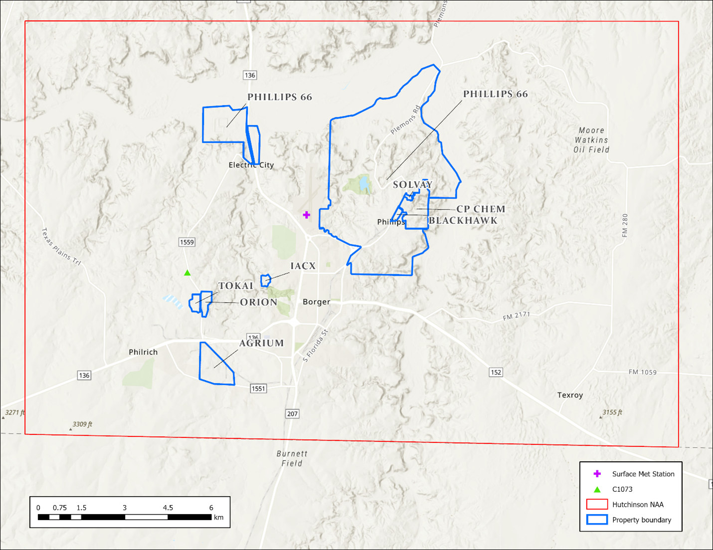
hutchinson-area-mapA map showing the Hutchinson County nonattainment area outlined in red. Within this area, the eight sulfur dioxide sources are shown, and outlined in blue. The sulfur dioxide monitor and surface meteorology monitor used for the attainment demonstration modeling for this area are shown as a green triangle in the west portion of the nonattainment area and a purple plus sign in the center of the nonattainment area, respectively.https://www.tceq.texas.gov/downloads/air-quality/modeling/images/hutchinson-area-map/viewhttps://www.tceq.texas.gov/downloads/air-quality/modeling/images/hutchinson-area-map/@@images/image-1200-e705a8411cb31aba6ac43189929daf0d.png?v=image
hutchinson-area-map
A map showing the Hutchinson County nonattainment area outlined in red. Within this area, the eight sulfur dioxide sources are shown, and outlined in blue. The sulfur dioxide monitor and surface meteorology monitor used for the attainment demonstration modeling for this area are shown as a green triangle in the west portion of the nonattainment area and a purple plus sign in the center of the nonattainment area, respectively.
