Water Quality Program Successes
TCEQ is constantly improving its activities to monitor, evaluate, and protect our natural waters. This page highlights successful strategies employed for preserving and improving the quality of rivers, lakes, and bays.


Preserving and Improving Water Quality
An overview of how TCEQ defines, measures, evaluates, and manages the quality of surface waters in Texas.
On this page:
Monitoring
TCEQ monitors the quality of surface water to evaluate physical, chemical, and biological characteristics of aquatic systems. Water quality is monitored in relation to human health concerns, ecological condition, and designated uses.
The same methods must be used by everyone collecting water samples, using reliable procedures that yield repeatable results. This allows for comparison of data collected by different organizations.
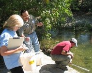
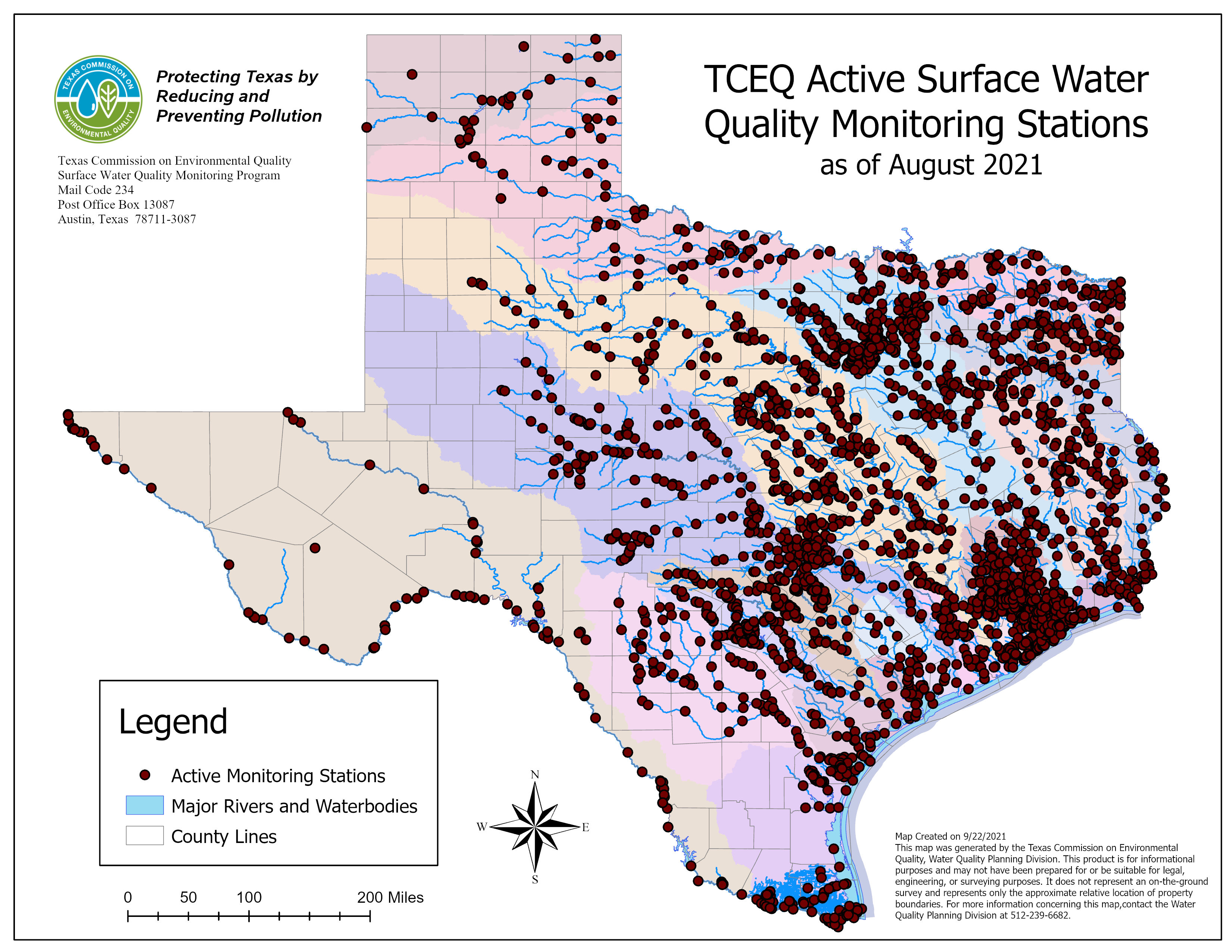 Routine Monitoring Sites
Routine Monitoring Sites
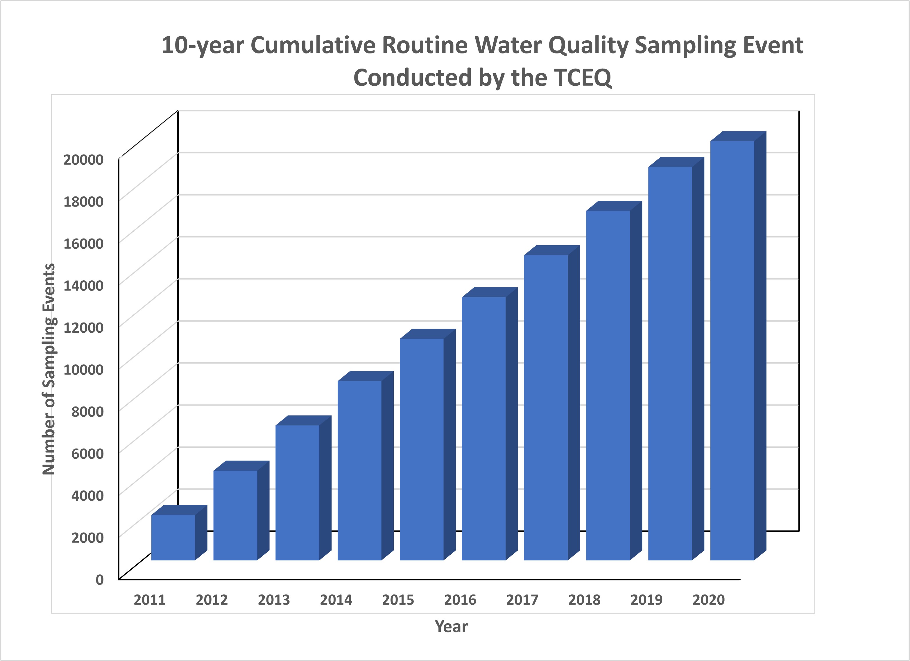
TCEQ assessed data from more than 2,666 stations to develop the 2020 Integrated Report of Surface Water Quality, which describes the condition of waterways throughout the state and identifies impaired waters.
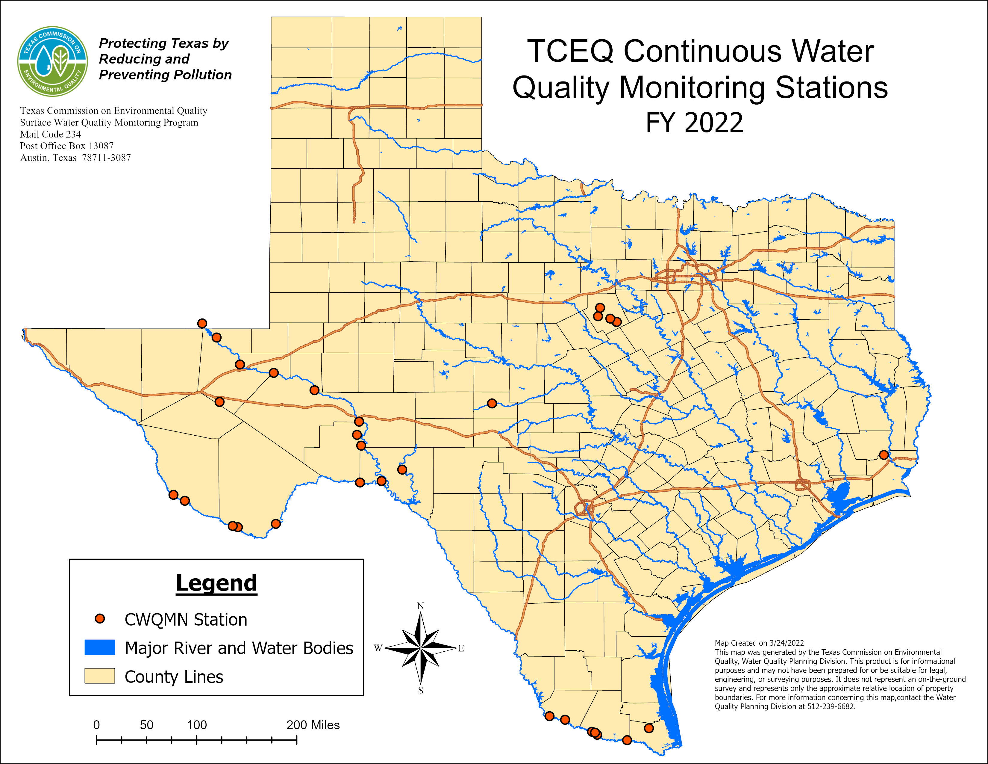
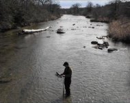
Continuous Monitoring Sites
Continuous Monitoring Sites
TCEQ continuously monitors water quality parameters at stations in selected watersheds throughout Texas.
In 2022, there were approximately 32 active continuous water quality monitoring stations throughout the state.
Screenshot of Coordinated Monitoring Planning Tool
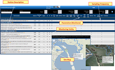
Coordinated Monitoring
TCEQ partners with numerous organizations to develop a statewide monitoring schedule that includes approximately 1,800 active sampling sites.
The schedule is coordinated statewide by TCEQ. Every spring, approximately 20 meetings are held all over the state to plan monitoring for the upcoming fiscal year.
Coordinated monitoring makes data collection more efficient by leveraging limited funds. Advantages of coordinated monitoring include:
- Eliminating duplication of effort, thereby saving resources.
- Increasing local participation in setting priorities and planning solutions.
- Ensuring consistent data quality for decision making.

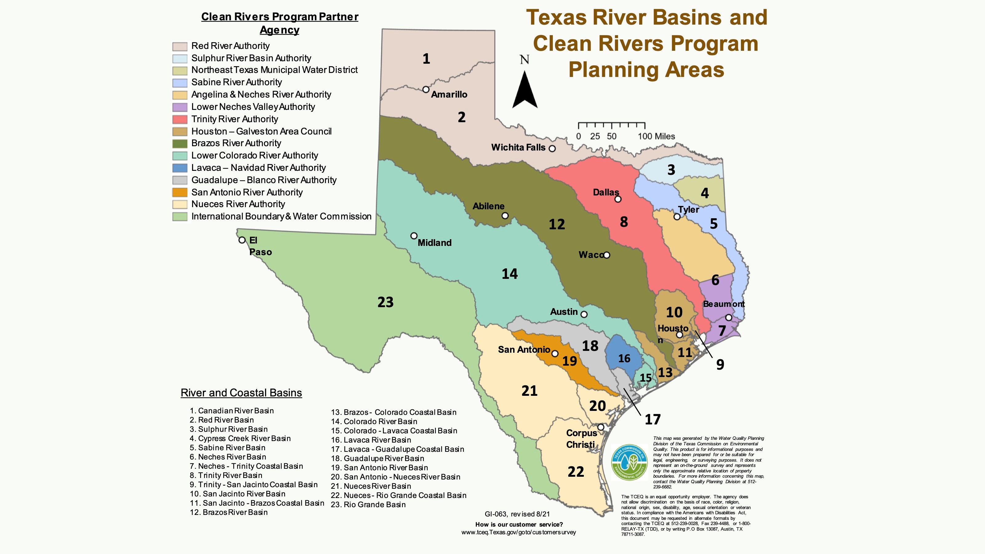
Clean Rivers Program
Established in 1991, CRP is a very successful partnership between TCEQ, regional water authorities, and the public.
Fifteen regional water authorities manage the program in 23 river and coastal basins.
Within each basin, the CRP partners implement the program by coordinating and conducting water quality monitoring, assessment, and stakeholder participation in order to improve the quality of surface water.
CRP partners collect more than 65% of the water quality data used by TCEQ.
Standards and Assessment
In order to protect water quality, we must first define and measure it. So we first define standards. A water quality standard is the combination, or pairing, of a use and associated criteria. Uses are the purposes for which the water should be suitable. Criteria are the indicators used to determine whether quality is good enough to support the uses.
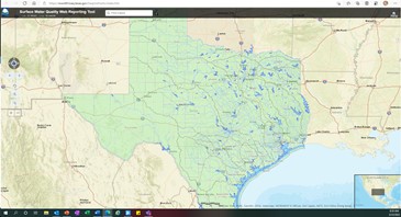
Measuring water quality requires reliable, consistent, quality-assured data. Those data are collected and shared through the SWQMIS—the Surface Water Quality Monitoring Information System.
Every two years, we report the status of Texas’ natural waters, based on historical data, in the Texas Integrated Report of Surface Water Quality. The Surface Water Quality Monitoring Program assesses data from all waters throughout the state to evaluate attainment of water quality standards.
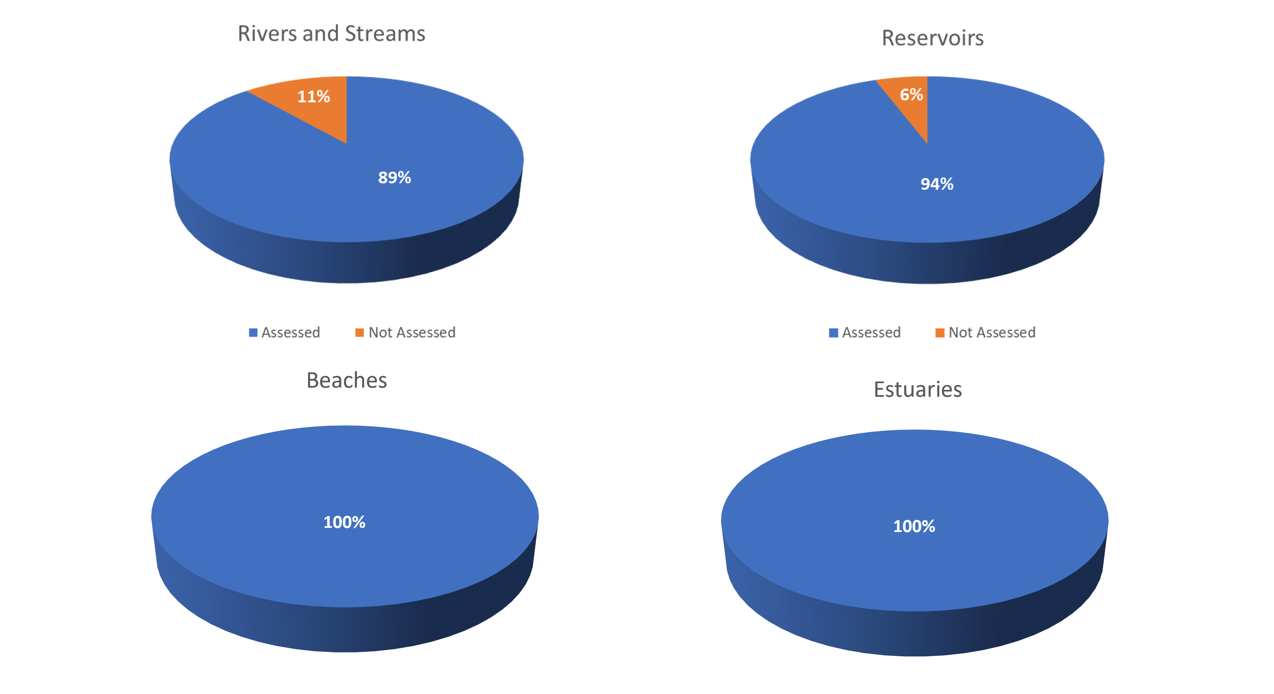

Areas Assessed in Texas in 2020
- 22,737 stream miles
- 2,296 square miles of reservoirs
- 2,547 square miles of estuaries
- 139 miles of recreational beaches
The total amount of area assessed for each type of water body depends on the amount of data collected within the specified time frame of assessment for the Integrated Report.

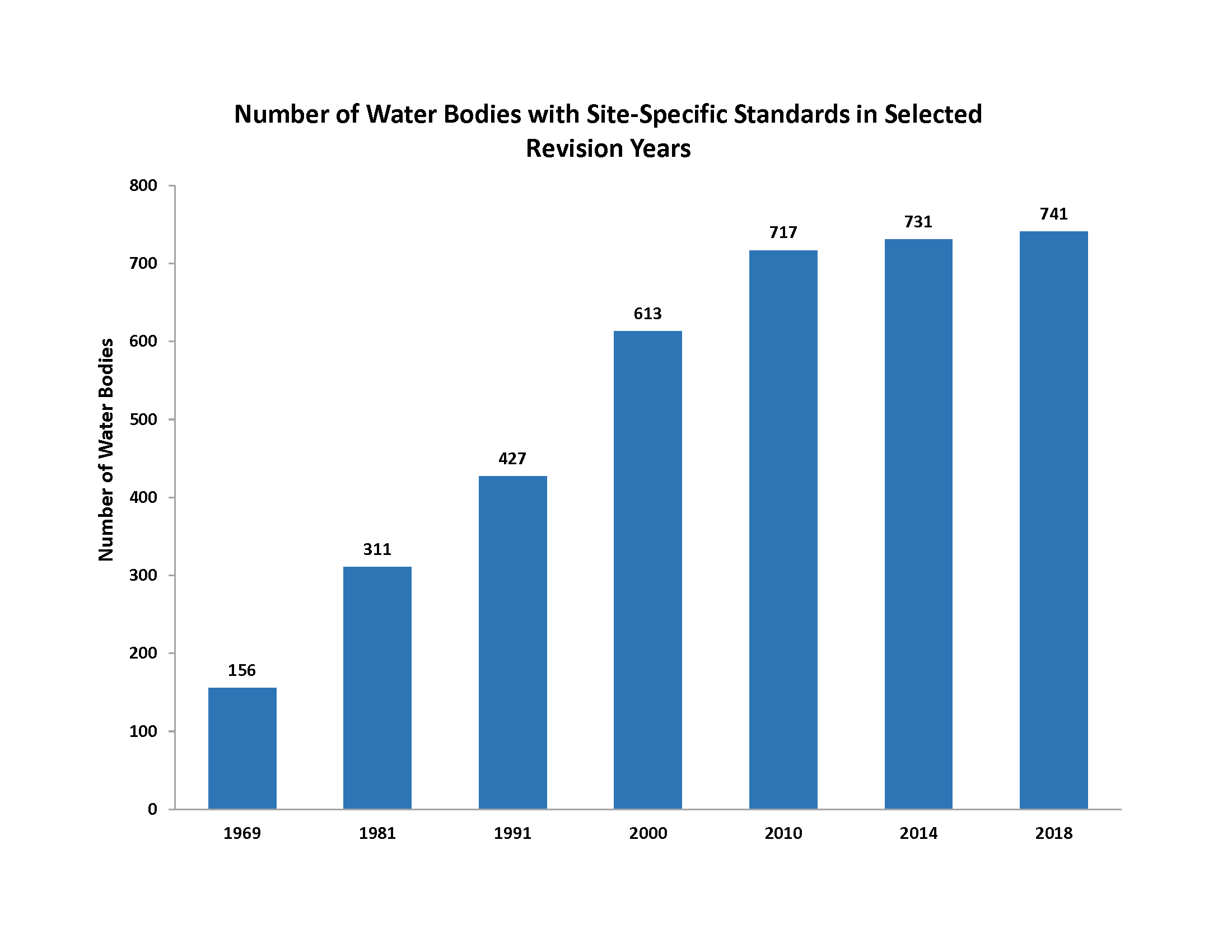
Site-Specific Standards
TCEQ continues to improve techniques and protocols for assigning tailored, site-specific uses.
Data Management
TCEQ’s Surface Water Quality Monitoring Information System (SWQMIS) is used to store, manage, and make publicly available water quality monitoring data from across the state. More than 20 separate organizations, including river authorities and local, state, and federal agencies, report data to SWQMIS.
In an average year, the Data Management and Analysis Team:
- Verifies, validates and/or loads more than 450,000 sample results.
- Creates 100 new monitoring stations in SWQMIS.
- Trains more than 30 new SWQMIS users.
- Manages over 36.1 million sample results and related metadata.
Restoration
When protective strategies are not sufficient to keep natural waters clean enough for all their uses, we take action to restore water quality.

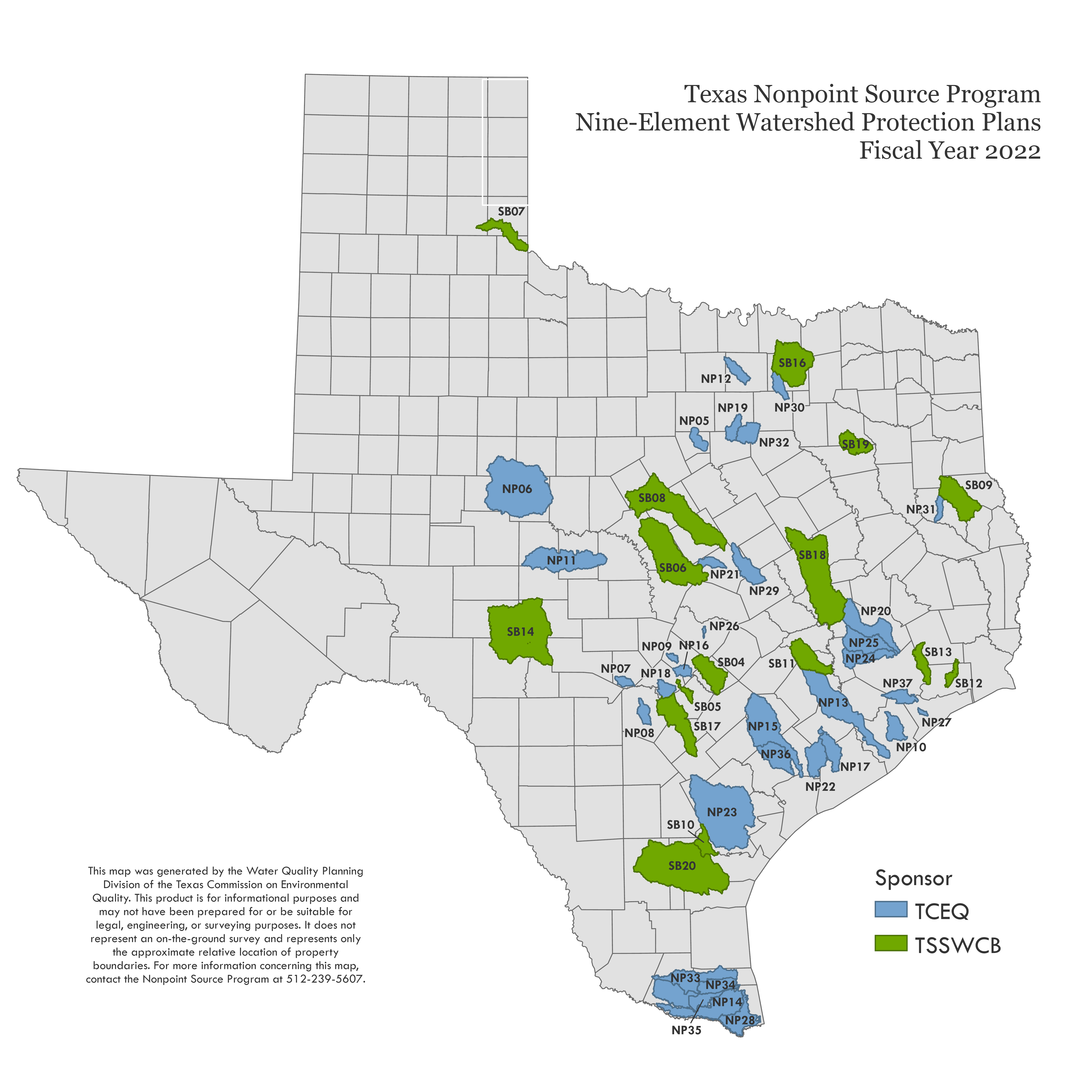
Nonpoint Source Program
The NPS Program administers federal funding to help watershed stakeholders address nonpoint sources of water pollution. The program is jointly administered by TCEQ and the Texas State Soil and Water Conservation Board (TSSWCB)
This program regularly updates a comprehensive Texas NPS Management Program and tracks its progress in NPS Annual Reports and in an interactive map, the NPS Project Viewer
The primary activities supported by these funds are grant projects to develop and implement Watershed Protection Plans (WPPs).
As of 2022, the total area addressed by WPPs in Texas is approximately:
- 6,021 Stream Miles
- 45,710 Acres Reservoir
- 108,966 Acres Estuary
- 202,222 Acres Oyster Waters
Each year, TCEQ uses a process called Request for Grant Applications (RFGA) to award federal NPS grants. The RFGA happens in the summer and awards 2-3 million dollars annually. Awarded projects receive 60 percent of their cost from federal funds. The balance of 40 percent must be matched with state or local funds or in-kind services.
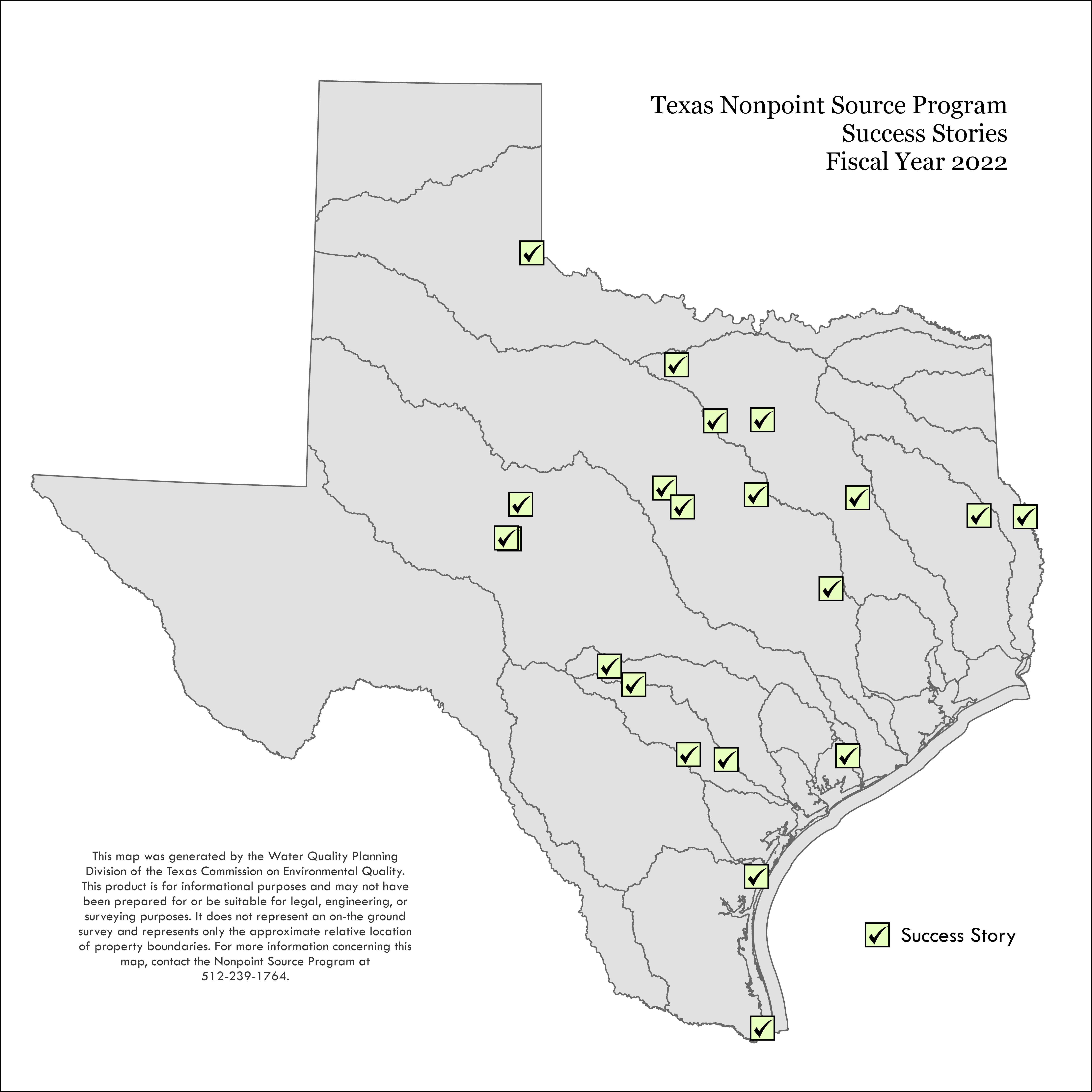
NPS Success Stories
Since 2008, EPA has recognized the success of activities to address NPS pollution which were funded by TCEQ and TSSWCB. These NPS success stories highlight activities to improve water quality.
- Aquilla Reservoir
- Attoyac Bayou
- Brownsville Ship Channel
- Buck Creek
- Catfish Creek
- Colorado River Below E.V. Spence Reservoir
- Concho River
- Fosdic Lake
- Guadalupe River Above Canyon Lake
- Lake Como
- Leon and South Leon rivers
- Lower San Antonio River
- Navasota River and Cedar Creek
- Oso Bay
- Sulphur Creek
- Toledo Bend Reservoir
- Tres Palacios Creek Above Tidal
- Upper Cibolo Creek
- Upper Leon River and Pecan Creek
- Upper San Antonio River
- West Fork Trinity River Above Bridgeport Reservoir
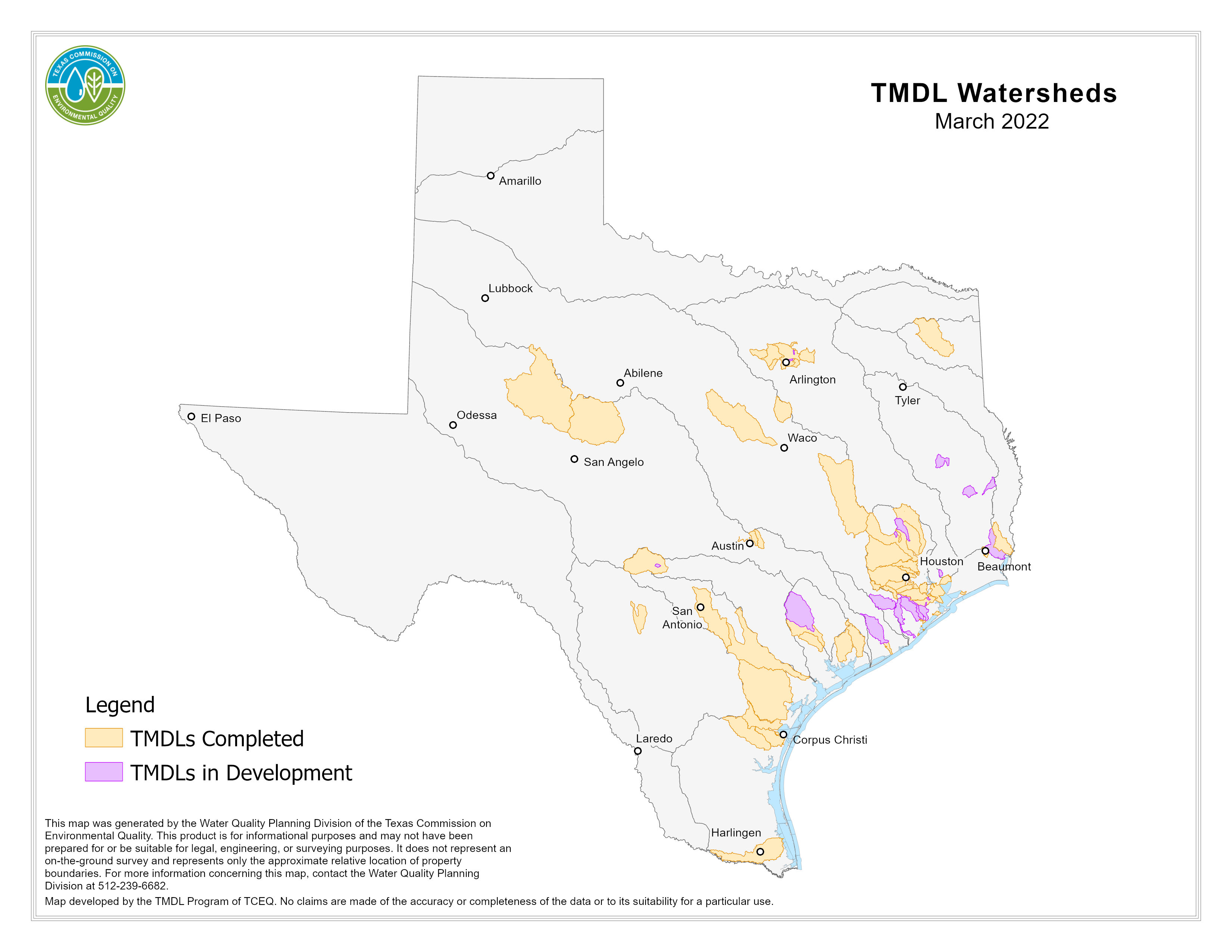
Total Maximum Daily Load Program
The TMDL Program works with local stakeholders to improve water quality in watersheds throughout Texas. Stakeholders are actively engaged in water quality restoration activities.
As of March 2022, the total area covered by the TMDLs and associated I-Plans was:
- 2,567 Stream Miles
- 28,164 Reservoir Acres
- 231 Estuary Square Miles
- 2 Recreational Beaches
Learn more about watersheds where TMDLs are being implemented.
Galveston Bay Estuary Program
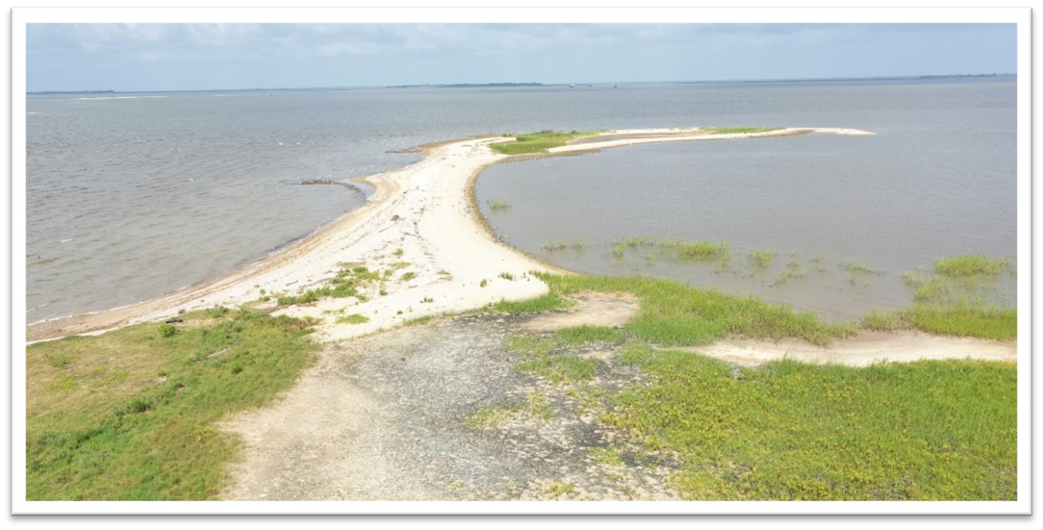
Since 2000, GBEP and its partners have protected, restored, and enhanced 35,233 acres and 206,047 linear feet of important coastal habitat (e.g., Trinity Bay Discover Center, pictured left), leveraging $169,837,830 in local, industry, state, and federal contributions. During fiscal years 2021 and 2022 (to date), GBEP protected, restored, and enhanced 6,055 acres of coastal wetlands and other important habitats. Through collaborative partnerships established by the GBEP, $5.125 million was secured for ongoing and future projects.
CAP supports GBEP and its partners’ efforts to preserve wetlands and other important coastal habitats to protect the long-term health and productivity of Galveston Bay. The CAP was developed to protect habitat and water quality, reduce flood and storm damage, provide recreational opportunities for residents in the area, and to preserve the region’s unique natural heritage.
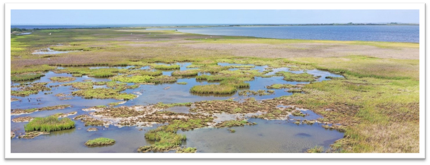
From 2021, the CAP successfully supported 11 acquisition projects (e.g., Chocolate Bay Preserve pictured left) within the Galveston Bay watershed, preserving 794 acres. In addition, CAP partners have closed on three projects in fiscal year 2022 (to date):
- Chocolate Bay Preserve, permanently protecting 4,714 acres of coastal habitat in Brazoria and Galveston Counties;
- Oyster Bayou, placing 458 acres of agricultural land under a conservation easement in Chambers County; and
- Sixth Addition to the Coastal Heritage Preserve Middle Tracts, permanently protecting 46 acres of coastal habitat in Galveston County.
There are six actively supported projects in the region that will result in the potential conservation of approximately 7,155 acres, and an additional 9,000 acres being targeted for future projects.
Implementation Tracker
The GBEP Implementation Tracking Viewer is a web mapping application that allows users to view GBEP and partner projects that implement actions from The Galveston Bay Plan, 2nd Edition. The viewer displays GBEP projects, which have been funded in part by Clean Water Act Section 320 funds from the Environmental Protection Agency, in addition to projects led by GBEP's local, state, and regional partners. Users can access details on how individual projects implement the actions found in The Galveston Bay Plan, 2nd Edition and filter the projects displayed on the map based on the action(s) implemented. Users can also explore approximate project locations in relation to data sets such as legislative districts and land cover.
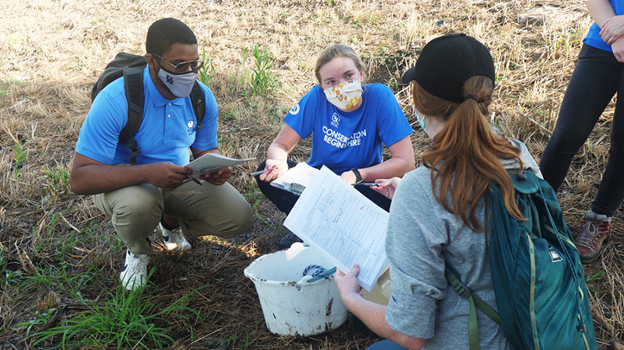
Targeted Bacteria Monitoring
The Houston-Galveston Area Council (H-GAC), using information from the Bacteria Implementation Group (BIG), aims to reduce bacteria concentrations in impaired streams in the BIG project area. The objectives of the Targeted Bacteria Monitoring project are to: (1) investigate bacteria sources in the most bacteria-impaired waterways in the BIG project area; and (2) work with local jurisdictions to reduce or eliminate those sources. H-GAC has worked in partnership with the Bayou Preservation Association through the use of Student Conservation Association interns to target sites within the top 10 most impaired assessment units (AUs) within the BIG project area.
The project is currently in its second phase and has successfully taken 78 samples in 4.5 AUs, 91% of which were above the state’s primary freshwater contact recreation standard for E. coli, 126 colony forming units (CFU) per 100 mL for freshwater. In addition, 74% of the samples taken were >399 CFUs. Data has been compiled into Targeted Monitoring Reports that have been submitted to the appropriate jurisdictions for remediation. Phase III of the project aims to complete monitoring on all remaining AUs and work with municipalities to make the necessary changes needed to reduce or eliminate sources of bacteria. The team is also working in collaboration with the City of Houston to develop an “Eyes on the Bayou” training, to equip residents and City staff with the knowledge necessary to effectively report problems to the appropriate authorities.