Lower Laguna Madre (Northern & Central): Developing a Watershed Protection Plan
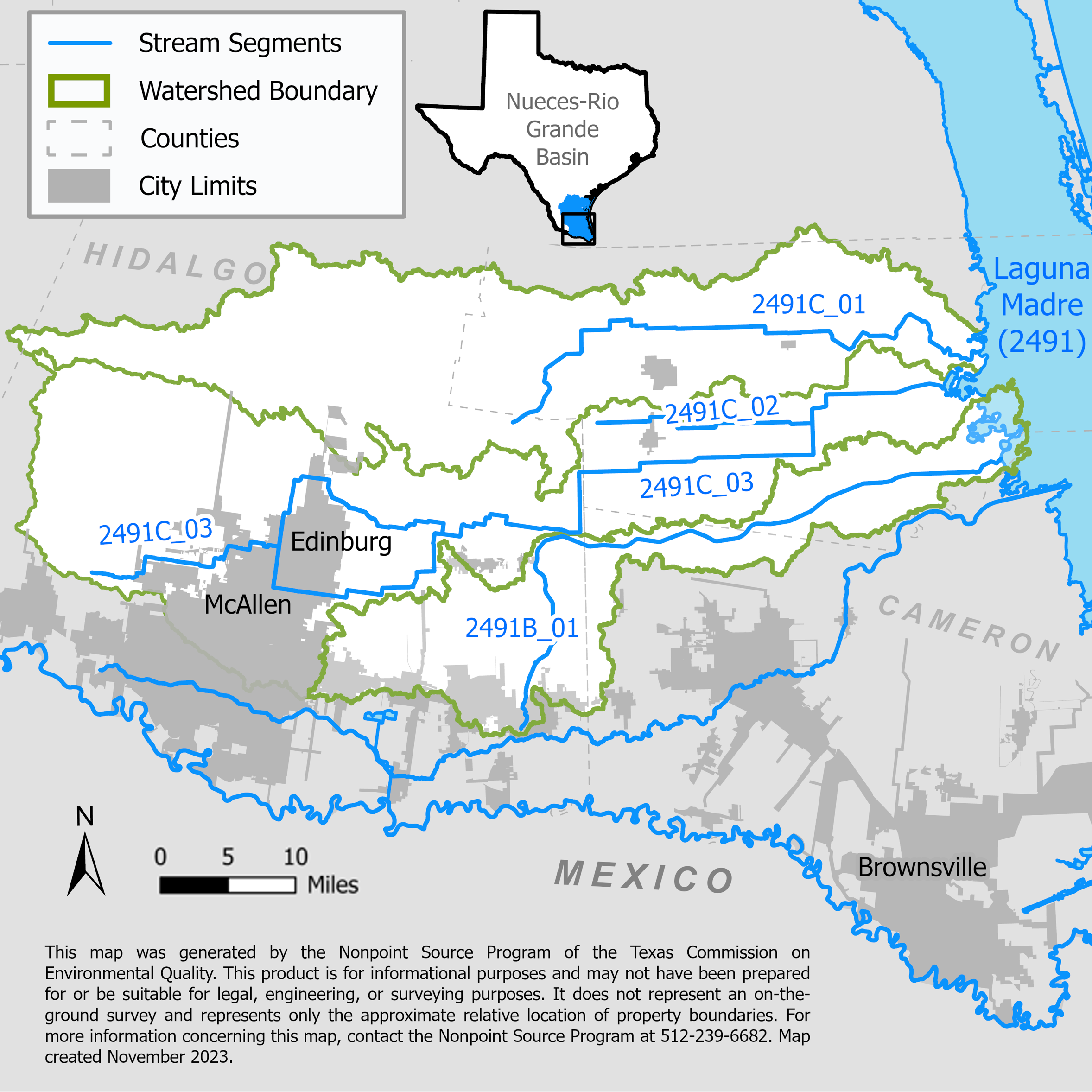
A multi-phased project which will identify existing data and data gaps to characterize the northern and central portions of the Lower Laguna Madre coastal watershed.

On this page:
Project Area
River Basin: Bays and Estuaries
Water Bodies: Raymondville Drain (2491C_01), Hidalgo Main (2491C_03), and North Floodway (2491B)
Location: Hidalgo, Cameron, and Willacy counties
Background
The Raymondville Drain and the Hidalgo main Floodwater Channel flow into the northern section of Laguna Madre (2491_01). The North Floodway flows into the central section of Laguna Madre (2491_02). Both the northern section of Laguna Madre and the central section of Laguna Madre do not meet state water quality standards for aquatic-life use due to low dissolved oxygen levels and have concerns for excess nutrients. The central section of Laguna Madre also does not meet the standards for primary contact recreation due to high bacteria levels. Although the Raymondville Drain, Hidalgo Floodway, and North Floodway meet water quality standards, their urban flows are main contributors of freshwater, wastewater, and stormwater to the Laguna Madre, a sensitive estuary.
Project Descriptions
The watershed characterization has involved three project phases:
February 2014 – August 2018
Texas Water Resources Institute identified existing data, data gaps, and collected data to fill the data gaps. These data were needed to characterize land use, water quality, and hydrologic circumstances in the north and central section of the Lower Laguna Madre watershed, and to determine a suitable analytical method for estimating pollutant loads. Stakeholder input helped to determine goals, objectives, and indicators for addressing the water quality impairments and concerns. The information and partnerships from this project provided the foundation for future development of a watershed protection plan.
September 2018 – August 2022
The University of Texas at Rio Grande Valley (UTRGV) initiated a characterization of the north and central portions of the Lower Laguna Madre watershed. Data were collected, analyzed, categorized, and evaluated to assess current conditions. This included identifying water quality issues, potential sources of pollution, and the relative contribution of each source.
UTRGV developed a conceptual model to show the linkage between the water quality problems and pollution sources. This analysis, to the extent possible, included a spatial and temporal exploration of water quality problems and sources of pollution in the watershed.
Gathering and analyzing existing water quality data assisted in identifying any remaining data gaps and what data need to be collected in the future. Both existing and new data will determine which analytical method will be used for estimating the amounts of pollutants entering the water bodies, and the reductions needed to improve water quality. Stakeholders were engaged throughout the process to provide local input.
September 2022 – August 2025
Research, Applied Technology, Education, Services, Inc. will continue work on the watershed characterization report and a water quality and flow monitoring program started with the Texas Water Development Board to characterize water quality and flow-dynamics in the northern and central Lower Rio Grande Valley waterways. The monitoring program will collect data three sites and write updated watershed characterization reports.
September 2024 – August 2026
This is the first phase of developing a watershed protection plan for the area. Research, Applied Technology, Education, Services, Inc. will continue the monitoring program and collect data at six sites.
For More Information
Northern and Central Lower Laguna Madre watersheds project webpage
To find out more about the NPS Program, call 512-239-6682 or email us at nps@tceq.texas.gov.

 Back to top