East Fork San Jacinto River: Developing a Watershed Protection Plan
The Houston-Galveston Area Council developed a watershed protection plan for the East Fork San Jacinto River watershed to address water quality issues.

On this page:
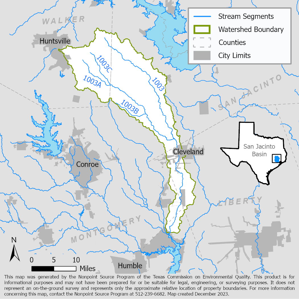
Project Area
River Basin: San Jacinto
Water Body: East Fork San Jacinto (1003), Winters Bayou (1003A), Nebletts Creek (1003B), and Boswell Creek (1003C)
Location: Cities of Houston, Splendora, Roman Forest, Huntsville, North Cleveland, Cleveland, and Plum Grove
Background
The East Fork San Jacinto watershed in Harris, Walker, Montgomery, Liberty, and San Jacinto counties includes 410 square miles of mixed land uses—from small urban centers to natural landscapes. The East Fork of the San Jacinto River is part of the larger San Jacinto River Basin above Lake Houston. Lake Houston is a vital source of drinking water, recreation, and wildlife habitat for the Houston region.
East Fork San Jacinto River and Winters Bayou are listed as impaired in the Texas Integrated Report of Surface Water Quality due to high bacteria levels that do not meet primary contact recreation standards. Boswell Creek has a concern due to elevated bacteria levels. Increasing urban development in the watershed is expected to exacerbate nonpoint source pollution and water quality issues.
Project Description
October 2021 – August 2024
The Houston-Galveston Area Council (H-GAC) led development of a watershed protection plan and facilitated a watershed partnership representing all stakeholders in the project area. The result of these efforts was a set of voluntary solutions that will guide efforts to improve water quality through 2040.
The U.S. Environmental Protection Agency accepted the East Fork San Jacinto River Watershed Protection Plan in 2024.
For More Information
East Fork San Jacinto Watershed Partnership
To find out more about the NPS Program, call 512-239-6682 or email us at nps@tceq.texas.gov.

 Back to top