Lampasas River: Implementing a Watershed Protection Plan
Texas A&M AgriLife Extension is updating an existing septic system database and conducting septic system inspections, repairs, and replacements in the Lampasas River watershed.

On this page:
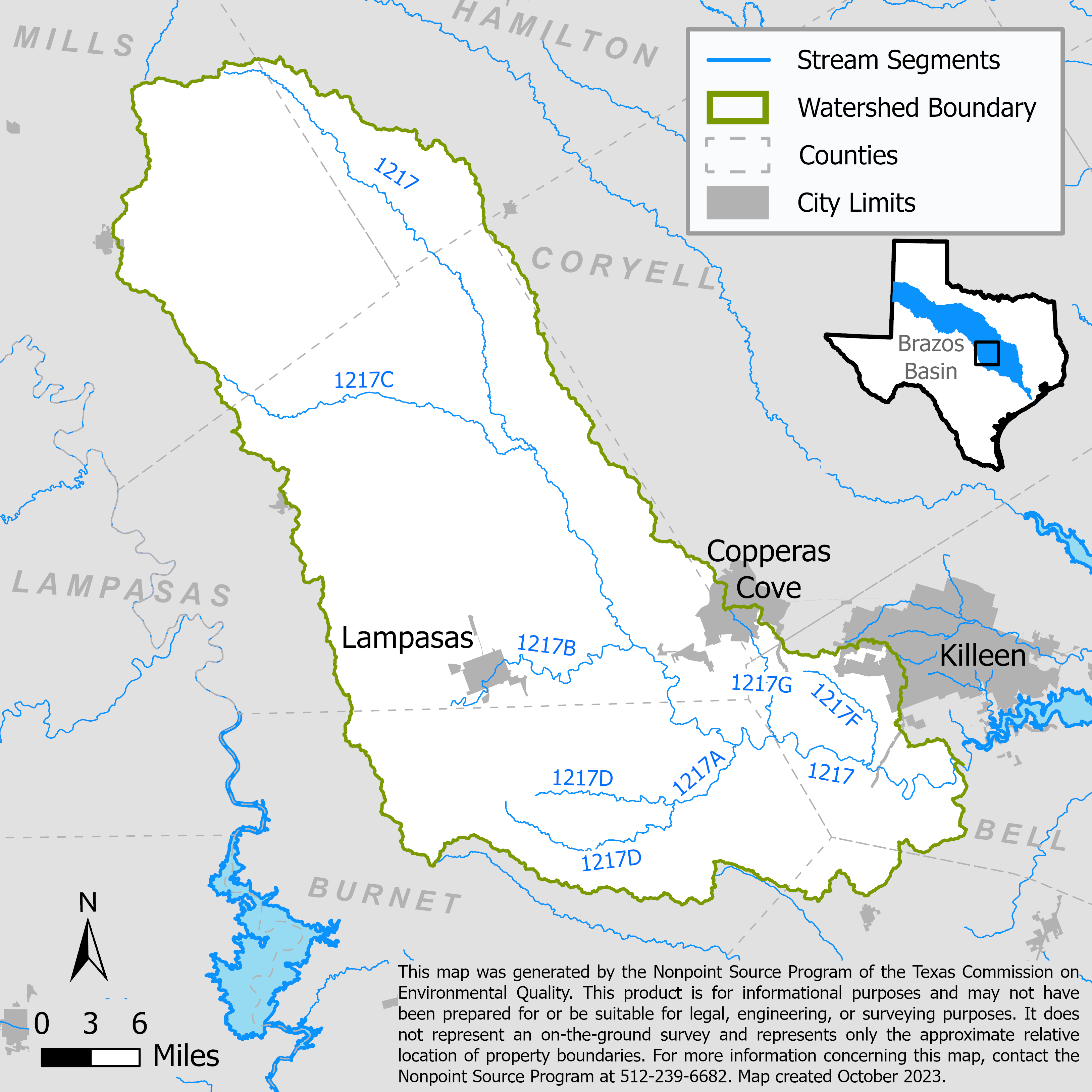
Project Area
River Basin: Lampasas
Water Bodies: Lampasas River above Stillhouse Hollow Lake (1217), Rocky Creek (1217A), Sulphur Creek (1217B), Simms Creek (1217C), North Fork Rocky Creek (1217D), South Rocky Creek (1217E), Reese Creek (1217F), and Clear Creek (1217G)
Location: Cities of Lampasas, Kempner, Copperas Cove, and Killeen
Background
The Lampasas River begins in eastern Mills County and flows southeast for 75 miles, passing through Lampasas, Burnet, and Bell counties. In Bell County the river turns northeast and is dammed five miles southwest of Belton, forming Stillhouse Hollow Lake.
Bacteria and nutrients are elevated in a portion of the Lampasas River above Stillhouse Hollow Lake, and low dissolved oxygen levels in Sulphur Creek are also identified as a concern in the 2020 Texas Integrated Report of Surface Water Quality for Clean Water Act Sections 305(b) and 303(d). North Fork Rocky Creek, a tributary of Lampasas River, has not met state water quality standards for aquatic-life use due to low levels of dissolved oxygen since 2006.
Population growth and rapid urbanization in the lower portion of the watershed put increasing stress on the chemical, physical, and biological integrity of the river. The Lampasas River Watershed Partnership, established in 2009, developed the Lampasas River Watershed Protection Plan (WPP) which the U.S. Environmental Protection Agency accepted in May 2013. The WPP identifies failing septic systems as a likely source of bacteria and nutrients.
Project Descriptions
January 2017 – August 2019
Texas A&M AgriLife Research developed a database that provides concise locations and details about septic systems in the watershed. The database will facilitate future septic system remediation projects by easily identifying areas with a high probability of septic system failure. These areas can then be targeted for inspections, repairs, and replacements. Priority is given to those failing systems located within 2000 feet of an identified waterbody.
October 2019 – August 2022
Texas A&M AgriLife Extension implemented septic system management measures of the Lampasas River WPP. They updated a septic system inventory database that was developed in the previous Lampasas River WPP implementation project, developed a program to guide and partially fund homeowners in the repair or replacement of failing septic systems, and conducted education and outreach on proper maintenance of septic systems.
September 2022 – February 2026
Texas A&M AgriLife Extension will continue the efforts of septic system remediation in the Lampasas River watershed by inspecting and repairing or replacing at least 20 failing septic systems. Project staff will also continue to update the septic system inventory database and will deliver education programs regarding proper maintenance of septic systems within the watershed.
For More Information
Lampasas River Septic System Resources webpage
To find out more about the NPS Program, call 512-239-6682 or email us at nps@tceq.texas.gov.

 Back to top