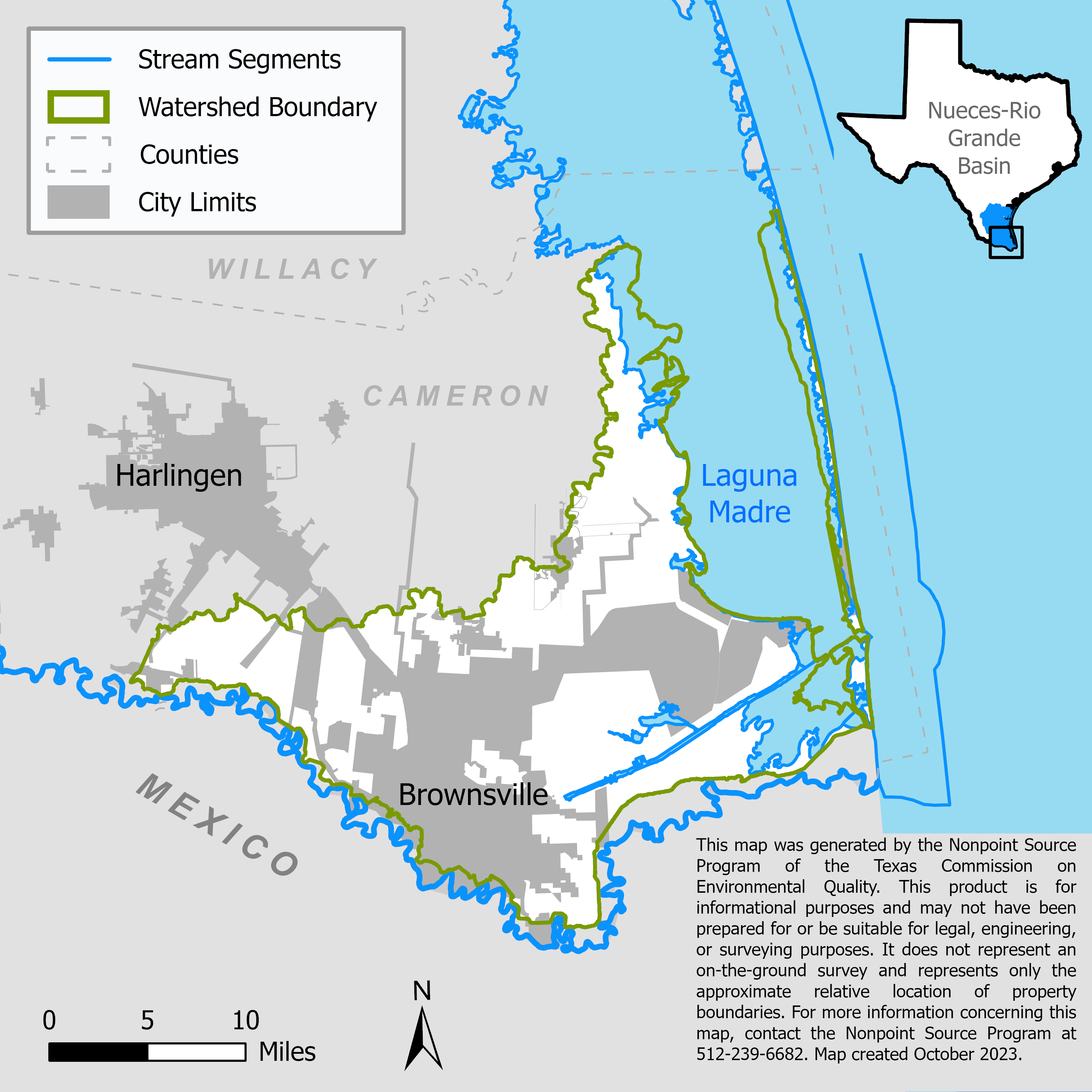
Lower Laguna Madre (South) and Brownsville Ship Channel Watershed Protection Plan Development
Multiple projects were implemented in which water quality data was collected and analyzed to characterize the southern portion of the Lower Laguna Madre and Brownsville Ship Channel watersheds and develop a watershed protection plan.

On this page:
Project Area
River Basin: Bays and Estuaries
Water Bodies: Brownsville Ship Channel (2494), Port Isabel Fishing Harbor (2494A), Drainage ditches flowing into San Martin Lakes (2494B), San Martin Lakes (2494C), Laguna Madre (2491), and South Bay (2493)
Location: Cameron County
Background
The southern portion of the Lower Laguna Madre and Brownsville Ship Channel (LLMBSC) watersheds, consists of the coastal regions between the Arroyo Colorado and Rio Grande watersheds, and includes the City of Brownsville and numerous townships in the surrounding area. Most of these watersheds drain to the Brownsville Ship Channel and then to the Lower Laguna Madre.
Portions of the Lower Laguna Madre do not meet water quality standards for aquatic life use because of low levels of dissolved oxygen and water quality standards for primary contact recreation use due to high levels of fecal bacteria. In 2016, a watershed partnership was formed and involved stakeholders to develop a watershed protection plan to address water quality issues.
Project Descriptions
February 2014 – August 2018
As the first phase of characterizing the LLMBSC watershed, Texas A&M AgriLife Research, Texas Water Resources Institute established a watershed stakeholder group, gathered existing geospatial data, maps, and water quality information. They identified data gaps and conducted water quality monitoring at two sites to fill the data gaps.
September 2017 – October 2022
University of Texas Rio Grande Valley implemented the second phase of the watershed characterization by collecting water quality and flow data from three sites on the main tributaries draining to Brownsville Ship Channel.
The intent of data collection was to delineated drainage patterns in the watershed and subwatersheds and develop a model to simulate existing and future pollutant contributions to the Ship Channel and Lower Laguna Madre by subwatershed, however this part of the project was not completed.
University of Texas Rio Grande Valley assigned a watershed coordinator to facilitate stakeholder input and involvement in watershed protection plan development, which included a public education component on watershed protection plans and watersheds to cultivate involvement.
November 2019 – October 2022
University of Texas Rio Grande Valley built a physical model of the LLMBSC watershed and used it to provide local education and outreach. They held stakeholder meetings to gain local support and involvement in the watershed protection plan development.
University of Texas Rio Grande Valley planned to continue data collection at the three tributary sites and an additional sampling location at San Martin Lake to contribute to modeling efforts, however these actions were not completed.
The LLMBSC Watershed Protection Plan was not completed.
For More Information
Lower Laguna Made and Brownsville Ship Channel Watershed Partnership website
To find out more about the NPS Program, call 512-239-6682 or email us at nps@tceq.texas.gov.

 Back to top