Shoal Creek: Watershed Protection Plan Development
The Shoal Creek Conservancy developed a watershed-based plan for Shoal Creek in Austin.

On this page:
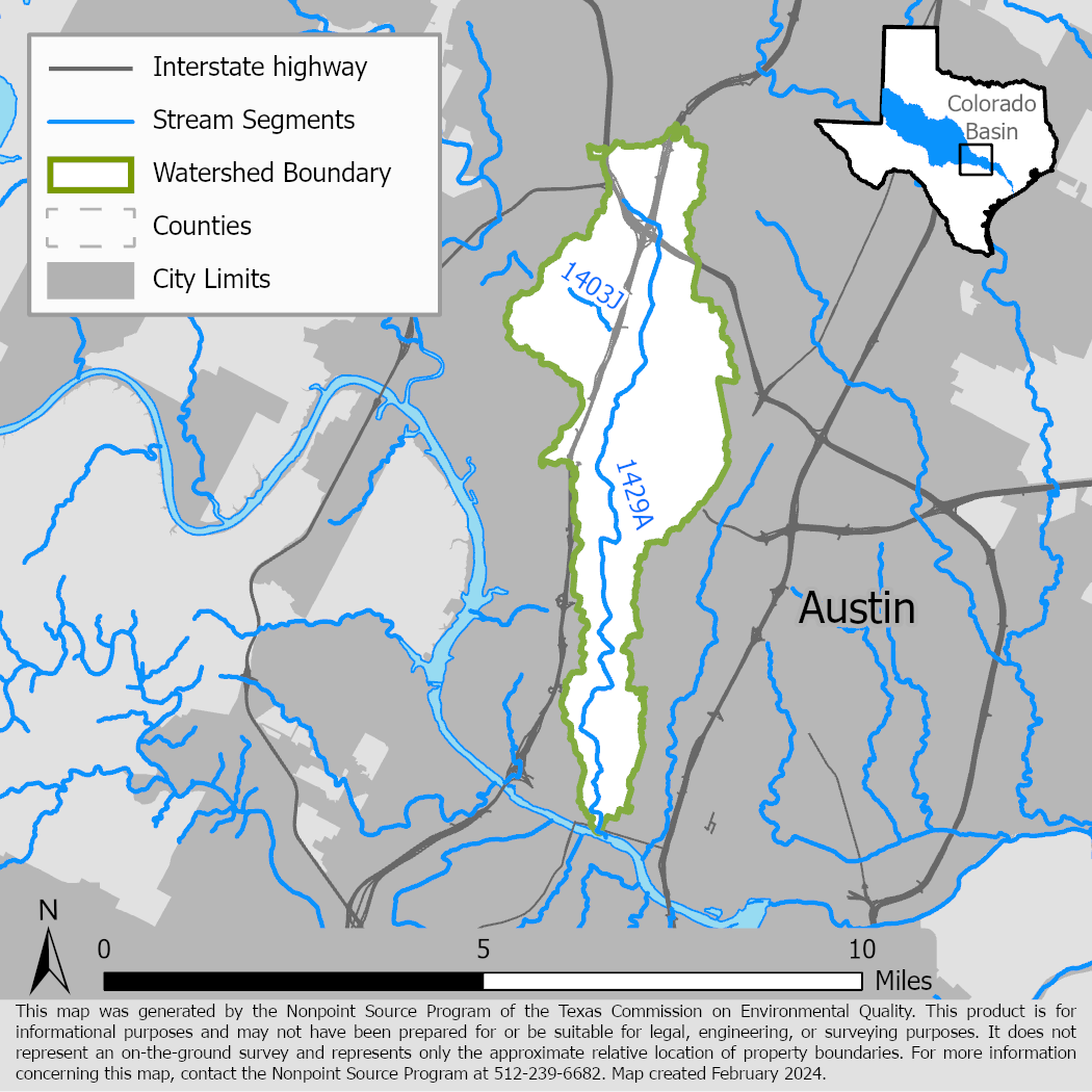
Project Area
River Basin: Colorado
Water Bodies: Shoal Creek (1429A) and Spicewood Springs (1403J)
Location: City of Austin
Background
The Shoal Creek watershed is in a fast developing and highly urbanized part of the City of Austin. The watershed is 53 percent impervious cover, and only 21 percent of that area is treated for water quality. Shoal Creek has two tributaries, Spicewood Springs, and Hancock Creek. Spicewood Springs has not met all water quality standards since 2002 because bacteria concentrations exceed the criteria used to evaluate attainment of the primary contact recreation use. In 2015, TCEQ adopted five total maximum daily loads for Austin area streams, including Spicewood Springs.
Shoal Creek meets water quality standards, but periodic water quality monitoring has shown elevated bacteria levels. The urban character of the Shoal Creek watershed presents special challenges and requires a multifaceted approach to restoring and protecting water quality.
Project Description
The Shoal Creek Conservancy (SCC) developed a watershed action plan for the Shoal Creek watershed that built on existing efforts by the City of Austin, nonprofit groups, and methodologies and findings from the approved total maximum daily load covering the Spicewood Springs tributary.
SCC used existing data to characterize the watershed, estimate pollutant loads, and the load reductions necessary for meeting water quality standards. SCC worked with a stakeholder committee to gather public input on management measures needed to achieve needed load reductions.
SCC also conducted watershed education and outreach activities including community forums, volunteer opportunities, and crowd sourcing. These activities engaged schools, community groups, and downtown businesses in watershed protection activities.
The Shoal Creek Watershed Action Plan was accepted by the U.S. Environmental Protection Agency in June 2021.
For More Information
Shoal Creek Watershed Action Plan webpage .
Austin Area Watershed TMDL Project webpage.
To find out more about the NPS Program, call 512-239-6682 or email us at nps@tceq.texas.gov.

 Back to top