Upper San Antonio River Watershed Protection Plan Implementation
Several grant-supported projects implemented the Upper San Antonio River Watershed Protection Plan through installation of low impact development features, stormwater monitoring, and extensive education and outreach programs.

On this page:
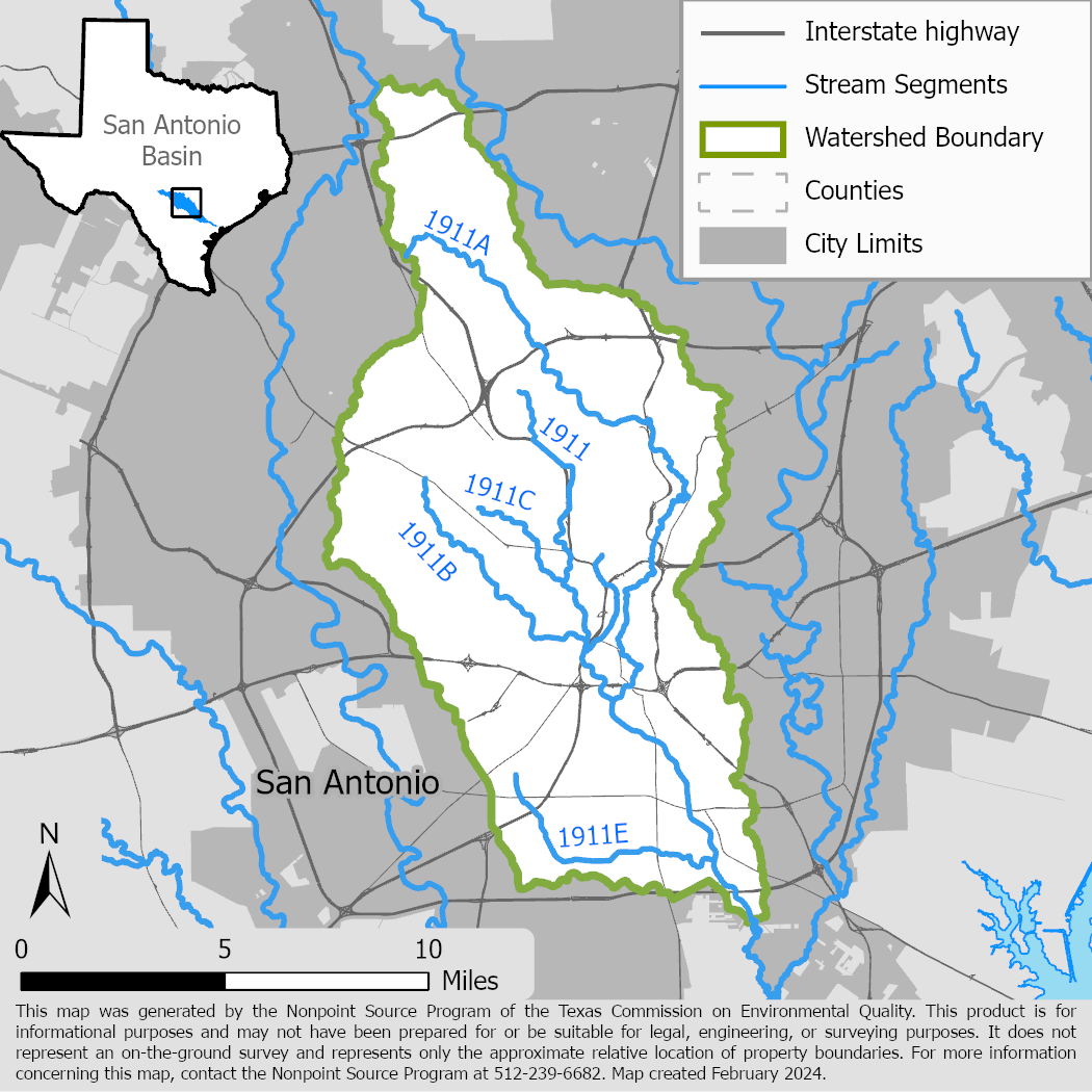
Project Area
River Basin: San Antonio
Water Body: Upper San Antonio River (1911)
Location: City of San Antonio
Background
Starting in 2000, portions of the Upper San Antonio River did not meet water quality standards for primary contact recreation because of high bacteria concentrations. In 2006, the San Antonio River Authority (SARA) completed the Upper San Antonio River Watershed Protection Plan (WPP), which was updated in 2014 and accepted by the United States Environmental Protection Agency (EPA) in 2015. In 2017 TCEQ adopted a total maximum daily load for this segment. The WPP recommended implementing low impact development (LID), a best management practice (BMP) for reducing stormwater pollution.
Project Descriptions
September 2011 – May 2015
The City of San Antonio designed and installed several LID features to reduce nonpoint source pollution in stormwater runoff in its redevelopment of the Mission Drive-In site on Roosevelt Avenue. These features included an infiltration basin, pervious turf, pervious pavement, two bioswales, a rain garden, and a rainwater harvesting system. The project monitored the performance of the LID features and analyzed their cost efficiency. The project examined and reported on the potential for incorporating these features as standard components in the city's development review standards.
September 2015 – February 2018
SARA demonstrated the feasibility of LID retrofit projects in a heavily urbanized area to reduce bacterial loading. LID features installed included rainwater harvesting cisterns, permeable pavement, and bioretention cells at two of SARA’s properties. SARA also conducted stormwater quality monitoring to evaluate the performance of the LID features.
October 2018 – August 2021
SARA, with stakeholder input, developed a master plan for the use of green stormwater infrastructure (GSI). The plan recommended BMPs for improving water quality and managing stormwater quantity, and the BMPs were prioritized based on their cost effectiveness. SARA’s watershed scale models identified sub-basins with the highest pollutant contributions which were used to prioritize sites with the highest potential for effective GSI implementation. The GSI Master Plan has become a template for implementation in other watersheds.
October 2019 – August 2022
The Southwest Research Institute (SWRI) implemented large-scale LID at their 1200-acre campus in San Antonio to treat stormwater runoff. LID features such as bioretention areas, rain gardens, bioswales, and planters were installed. The placement of LID features focused on treating stormwater runoff that bypassed three pre-existing detention basins on campus. The features were designed under the technical guidance of SARA and utilized results from SWRI’s stormwater routing models.
For More Information
To find out more about the NPS Program, call 512-239-6682 or email us at nps@tceq.texas.gov.

 Back to top