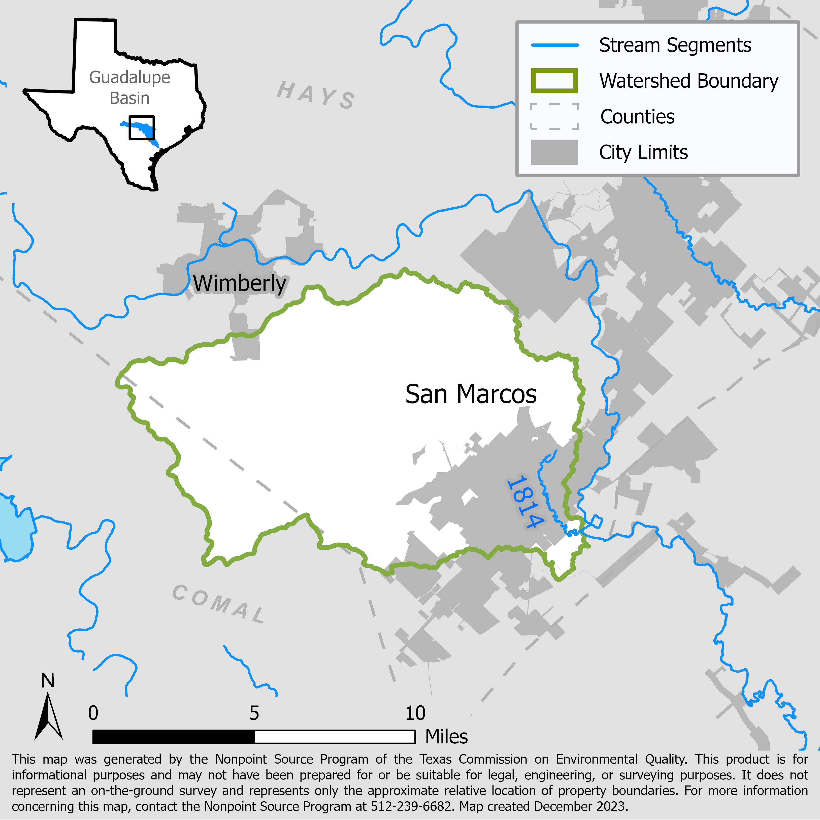
Upper San Marcos River: Implementing a Watershed Protection Plan
Projects implement management measures of the Upper San Marcos River Watershed Protection Plan, conducting public outreach, reviewing monitoring data for water quality trends, and installing green infrastructure to decrease nonpoint source pollution.

On this page:
Project Area
River Basin: Guadalupe
Water Body: Upper San Marcos River (1814)
Location: Hidalgo, Cameron, and Willacy counties
Background
The Upper San Marcos River begins in the City of San Marcos at Spring Lake and flows 4.5 miles to its confluence with the Blanco River. In 2010, the Upper San Marcos River did not meet state water quality standards due to high concentrations of total dissolved solids (TDS) but has since met standards. The San Marcos Watershed Initiative, formed in 2012, guided stakeholders in the development of a watershed protection plan (WPP) to address the concerns for TDS, bacteria, nutrients, and sediment in the San Marcos River. They developed the Upper San Marcos WPP to mitigate future water quality issues in the watershed, which was accepted by the U.S. Environmental Protection Agency in 2018.
Project Descriptions
August 2018 – August 2020
Texas State University implemented green infrastructure aimed at managing the quantity and improving the quality of stormwater in the Upper San Marcos River watershed. Green infrastructure was incorporated in new developments in the watershed and retrofitted into existing developments. This will encourage further use of green infrastructure and provide information on cost and effectiveness of these practices in reducing pollution. Texas State University also provided education and outreach, a review of water quality protection ordinances, and coordination of water quality monitoring activities.
June 2020 – February 2023
Windmill Branch flows into Sessom Creek, a tributary of the Upper San Marcos River. Texas State University re-vegetated the banks of Windmill Branch, restored riparian habitat, and implemented green infrastructure to reduce the amount of sediment that enters the water body and increase infiltration to groundwater.
September 2024 – August 2026
The City of San Marcos will continue implementing the Upper San Marcos WPP with two projects:
- The first project will construct a natural channel in Sessom Creek and Windmill Branch and plant native plants to stabilize the creek, reduce erosion, and minimize pollutants in the Upper San Marcos River.
- The second project will install green infrastructure in downtown San Marcos to treat and reduce the amount of stormwater runoff by installing permeable road pavers and a filtration system.
For More Information
To find out more about the NPS Program, call 512-239-6682 or email us at nps@tceq.texas.gov.

 Back to top