West Lake Houston Basin: Implementing Watershed Protection Plans
The Houston-Galveston Area Council will coordinate implementing three watershed protection plans in the Houston area that reflect shared water quality issues, overlapping stakeholder bases, and management measures to address nonpoint source pollution.

On this page:
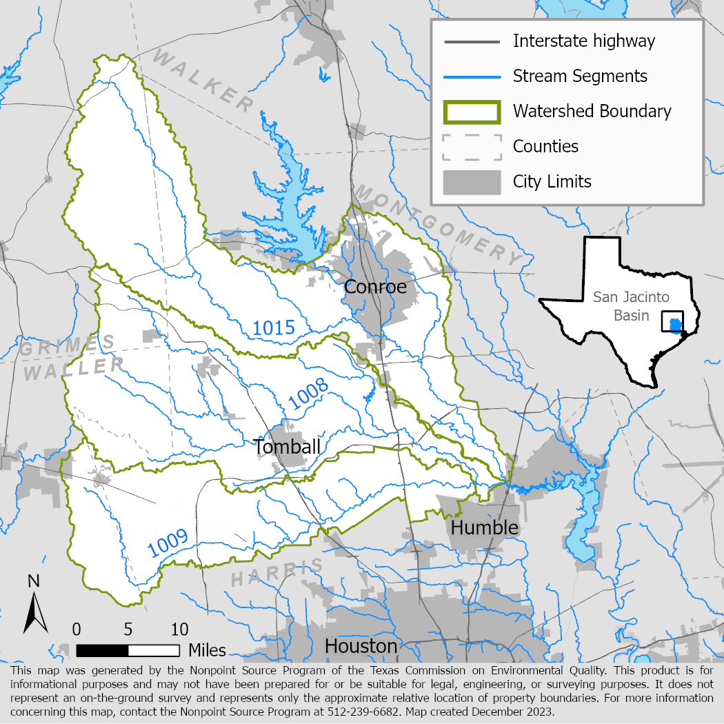
Project Area
River Basin: San Jacinto
Water Bodies: West Fork San Jacinto River (1004), Spring Creek (1008), Cypress Creek (1009), and Lake Creek (1015)
Location: Harris, Montgomery, Grimes, and Waller counties
Background
Cypress Creek, Spring Creek, Lake Creek and the West Fork of the San Jacinto River flow through major population centers north of Houston. Together these waterways represent the entire western basin of the Lake Houston watershed below Lake Conroe. These water bodies provide a source of drinking water for millions in the Houston-Galveston region, serve as prominent regional recreation venues, and support robust ecological communities. However, part or all of each of these waterways are impaired because of one or more water quality parameters. The waterways do not meet water quality standards mostly for primary contact recreation use due to high bacteria levels and they have concerns for elevated nutrients.
Watershed protection plans were developed for all four waterways to address the impairments and other water quality concerns. The watersheds are also part of the larger Implementation Plan for Total Maximum Daily Load bacteria reduction in the Houston region. Other regional planning efforts include water quality-oriented conservation and surface water quality monitoring under the Clean Rivers program. A wide range of partners are also engaged in adjacent local efforts for water quality, focusing on flood mitigation, urban forestry, and stormwater management.
Project Description
December 2022 – August 2025
The Houston-Galveston Area Council will coordinate joint implementation of the watershed protection plans for West Fork San Jacinto River and Lake Creek, Cypress Creek, and Spring Creek. These efforts will include collecting and assessing water quality data, coordinating stakeholder groups, generating financial and technical resources for partners, hosting education and outreach events, and installing structural best management practices. The Council will also support ongoing partner efforts to address water quality in the watershed, which include flood resilience, conservation, and forestry programs.
For More Information
Houston-Galveston Area Council Watershed-based Plans
To find out more about the NPS Program, call 512-239-6682 or email us at nps@tceq.texas.gov.

 Back to top