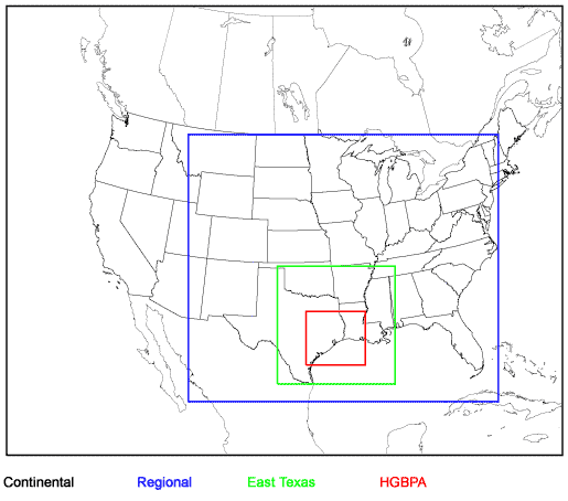
Houston-Galveston-Brazoria 8-Hour Ozone SIP Modeling (2000 Episode): MM5 Modeling Domain
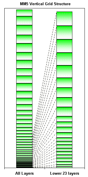
Meteorological model MM5 modeling domain horizontal grid and vertical layer structures for the Houston-Galveston-Brazoria 8-hour ozone SIP (2000 episode).
Following are the MM5 horizontal grid and vertical layer structures used in the Houston-Galveston-Brazoria (HGB) eight-hour ozone SIP modeling.
Horizontal Grid Structure
The MM5 modeling domain is defined with the Lambert Conformal Conic map projection:
| First True Latitude (Alpha): | 30ºN |
| Second True Latitude (Beta): | 60ºN |
| Central Longitude (Gamma): | 100ºW |
| Projection Origin: | (100ºW, 40ºN) |
| Spheroid: | Perfect sphere, radius = 6370 km |
The horizontal modeling domain grid structure consists of a coarse-grid continental domain and four nested subdomains: the Regional Domain, the East Texas Domain, the Houston-Galveston-Brazoria-Beaumont-Port Arthur (HGBPA) Domain, and the optional Houston-Galveston Bay (HG) Domain.
| Domain | Range (km) | Number of Grid Points | Cell Size (km) | |||
|---|---|---|---|---|---|---|
| Easting | Northing | Easting | Northing | Easting | Northing | |
| Continental | (-2808,2808) | (-2268,2268) | 53 | 43 | 108 | 108 |
| Regional | (-972,2160) | (-1728,972) | 88 | 76 | 36 | 36 |
| East Texas | (-72,1116) | (-1548,-360) | 100 | 100 | 12 | 12 |
| HGBPA | (216,816) | (-1356,-816) | 151 | 136 | 4 | 4 |
| HG | (424,520) | (-1156,-1076) | 97 | 81 | 1 | 1 |
HGB SIP MCR MM5 Modeling Domain
Vertical Layer Structure
Note: AGL = Above ground level. |
|