Today's Texas Air Quality Forecast
The latest forecast for air quality conditions in Texas' metropolitan areas.
August 1, 2026
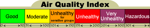
Forecast is for Ozone, PM2.5, & PM10, and is based on EPA's Air Quality Index (AQI)
| Forecast Region (Click name for AIRNOW version) |
Fri 07/31/2026 |
Sat 08/01/2026 |
Sun 08/02/2026 |
Mon 08/03/2026 |
Tue 08/04/2026 |
|---|---|---|---|---|---|
| Amarillo | Ozone/PM2.5 | Ozone/PM2.5 | Ozone | Ozone | Good |
| Austin | PM2.5 | PM2.5 | Ozone/PM2.5 | Ozone/PM2.5 | Ozone/PM2.5 |
| Beaumont-Port Arthur | Good | Good | PM2.5 | PM2.5 | PM2.5 |
| Big Bend | Good | Good | Good | Good | Good |
| Brownsville-McAllen | PM2.5 | PM2.5 | PM2.5 | PM2.5/PM10 | PM2.5/PM10 |
| Bryan-College Station | PM2.5 | PM2.5 | PM2.5 | PM2.5 | PM2.5 |
| Corpus Christi | PM2.5 | PM2.5 | PM2.5 | PM2.5 | PM2.5/PM10 |
| Dallas-Fort Worth | Ozone/PM2.5 | Ozone/PM2.5 | Ozone/PM2.5 | Ozone | Ozone |
| El Paso | Ozone/PM2.5/PM10 | Ozone/PM2.5/PM10 | Ozone | Ozone | Ozone |
| Houston | PM2.5 | PM2.5 | Ozone* | Ozone/PM2.5 | Ozone/PM2.5/PM10 |
| Laredo | PM2.5 | PM2.5 | PM2.5 | PM2.5 | PM2.5/PM10 |
| Lubbock | Ozone/PM2.5 | Ozone/PM2.5 | Ozone | Ozone | Good |
| Midland-Odessa | Ozone/PM2.5 | Ozone/PM2.5 | Ozone/PM2.5 | Ozone | Ozone |
| San Antonio | PM2.5 | PM2.5 | Ozone/PM2.5 | Ozone/PM2.5 | Ozone/PM2.5/PM10 |
| Tyler-Longview | PM2.5 | Ozone/PM2.5 | PM2.5 | Ozone/PM2.5 | Ozone/PM2.5 |
| Victoria | PM2.5 | PM2.5 | PM2.5 | PM2.5 | PM2.5/PM10 |
| Waco-Killeen | PM2.5 | Ozone/PM2.5 | Ozone/PM2.5 | Ozone/PM2.5 | Ozone/PM2.5 |
| An asterisk (*) indicates that an Ozone Action Day is or will be in effect for the indicated region. | |||||
| A caret (^) indicates that levels of PM may exceed the applicable short-term NAAQS. For more information see the following TCEQ websites:Air Pollution from Particulate Matter and Voluntary Tips for Citizens and Business to Reduce Emissions. | |||||
Forecast Discussion
Light winds, warm to hot temperatures, abundant afternoon sunshine, and/or elevated incoming background levels could be enough for ozone to reach the middle of the "Moderate" range in parts of the Dallas-Fort Worth area; the lower end of the "Moderate" range in parts of the Amarillo, El Paso, Lubbock, and Midland-Odessa areas; and the upper end of the "Good" range in parts of the Austin, Houston, and San Antonio areas, with the highest concentrations in the afternoon and early evening.
Light density residual smoke will persist over most of the state associated with the wildfires and burning activities in Oregon, Washington and the Canadian Northwest Territories as well as southern British Columbia as a weak cold front steers a more moderately dense plume of smoke over the northern parts of the Texas Panhandle and North Central Texas along the Oklahoma border. Additionally, the light density residual smoke attributed to the burning activities across the Mexican Isthmus of Tehuantepec will also continue filtering over South Texas and merging with the Pacific Northwest and Canadian smoke over the state. Meanwhile, very light density residual smoke associated with likely ongoing small, scattered burning activities across parts of eastern Texas, combined with slightly elevated urban fine particulate background levels associated with light daytime winds and/or elevated relative humidity levels, should continue to contribute towards raising PM2.5 levels across portions of the eastern two-thirds of the state. Industrial activities across the Permian Basin could continue producing light density residual smoke and slightly elevate PM2.5 levels across parts of this region as well. A light density plume of Saharan dust is weakening and dispersing over the state and not expected to contribute much towards raising fine particulate matter over Texas. Overall, the daily PM2.5 AQI may rise to the lower end of the "Moderate" range in parts of the Amarillo, Austin, Brownsville-McAllen, Bryan-College Station, Corpus Christi, Dallas-Fort Worth, Houston, Laredo, Lubbock, Midland-Odessa, San Antonio, Tyler-Longview, Victoria, and Waco-Killeen areas and the upper end of the "Good" range for most of the Beaumont-Port Arthur and Big Bend areas. The daily PM10 should remain in the upper end of the "Good" range for most of the of the Austin, Brownsville-McAllen, Corpus Christi, Dallas-Fort Worth, Houston, San Antonio, and Victoria areas.
There is the possibility for pockets of low "Moderate" urban fine particulate PM2.5 concentrations for several hours across portions of far West Texas associated with light morning winds and limited morning vertical mixing. Slightly elevated wind gusts from thunderstorm outflows later on this evening may generate patchy blowing dust through parts of far West Texas, possibly raising PM2.5 levels at times to the "Moderate" range. Newer model guidance suggests that the overall daily PM2.5/PM10 AQIs may reach the lower end of the "Moderate" range in parts of the region, which includes the El Paso area.
Light winds, warm to hot temperatures, abundant afternoon sunshine, and/or elevated incoming background levels could be enough for ozone to reach the middle of the "Moderate" range in parts of the Amarillo and Dallas-Fort Worth areas; the lower end of the "Moderate" range in parts of the El Paso, Lubbock, Midland-Odessa, Tyler-Longview, and Waco-Killeen areas; and the upper end of the "Good" range in parts of the Austin, Houston, and San Antonio areas, with the highest concentrations in the afternoon and early evening.
Model guidance suggests that light density residual smoke attributed to the wildfires and burning activities in Oregon, Washington and the Canadian Northwest Territories as well as southern British Columbia will linger over most of the state as the aforementioned cold front steers the plume of denser smoke over the Texas Panhandle, North Central Texas, the South Plains, the Permian Basin, Northeast Texas, and possibly parts of Central Texas as well. Depending on the burning activities across the Mexican Isthmus of Tehuantepec, light density residual smoke may continue to filer over South Texas and merge with the Pacific Northwest and Canadian smoke over the state as well. Meanwhile, very light density residual smoke associated with possibly ongoing small, scattered burning activities across parts of eastern Texas, combined with slightly elevated urban fine particulate background levels associated with light daytime winds and/or elevated relative humidity levels, may continue to contribute towards raising PM2.5 levels across portions of the eastern two-thirds of the state. Industrial activities across the Permian Basin could continue producing light density residual smoke and slightly elevate PM2.5 levels across parts of the region as well. The previously mentioned light density plume of Saharan dust is forecast to completely weaken and dissipate over the state and is not expected to contribute towards fine particulate matter over Texas. Overall, the daily PM2.5 AQI may rise to the middle of the "Moderate" range in parts of the Dallas-Fort Worth and Tyler-Longview areas; the lower end of the "Moderate" range in parts of the Amarillo, Austin, Brownsville-McAllen, Bryan-College Station, Corpus Christi, Houston, Laredo, Lubbock, Midland-Odessa, San Antonio, Victoria, and Waco-Killeen areas; and the upper end of the "Good" range most of the Beaumont-Port Arthur and Big Bend areas.
Light morning winds and lower morning vertical mixing heights may limit early day dispersion of urban fine particulate matter for parts of far West Texas. Additionally, the potential for patchy blowing dust associated with slightly elevated winds gusts from thunderstorm outflows again in the late evening hours, may possibly raise PM2.5 levels at times to the "Moderate" range. The daily PM2.5/PM10 AQIs may remain in the lower end of the "Moderate" range in parts of the region, which includes the El Paso area.
An Ozone Action Day will be in effect on Sunday for the Houston area. Light winds, warm to hot temperatures, abundant afternoon sunshine, and/or elevated incoming background levels could be enough for ozone to reach the lower end of the "Unhealthy for Sensitive Groups" range in the central region and on the south side of the Houston area; the upper end of the "Moderate" range on the south side of the Dallas-Fort Worth area, on the west side of the El Paso area, and in parts of the Amarillo area; the middle of the "Moderate" range in parts of the Austin, Lubbock, Midland-Odessa, and San Antonio areas; the lower end of the "Moderate" range in parts of the Waco-Killeen area; and the upper end of the "Good" range in parts of the Bryan-College Station and Tyler-Longview areas, with the highest concentrations in the afternoon and early evening.
Model guidance indicates the moderately dense plume of wildfire smoke from the burning activities in Oregon, Washington and the Canadian Northwest Territories as well as southern British Columbia will expand over most of the state with the exception of deep South Texas with lighter amounts over this region, however most of the denser smoke should remain aloft. Additionally, depending on the burning activities across the Mexican Isthmus of Tehuantepec, light density residual smoke may also continue to filer over South Texas and merge with this denser plume of Pacific Northwest and Canadian smoke too. Meanwhile, very light density residual smoke associated with possibly ongoing small, scattered burning activities across parts of eastern Texas, combined with slightly elevated urban fine particulate background levels associated with light daytime winds and/or slightly elevated relative humidity levels, may continue to contribute towards raising PM2.5 levels across most of the state. Industrial activities across the Permian Basin may continue producing light density residual smoke and slightly elevate PM2.5 levels across parts of the region as well. Model guidance suggests that another light density plume of Saharan dust may arrive over deep South Texas and slightly contribute towards raising fine particulate matter over this region of the state. Overall, the daily PM2.5 AQI may rise to the middle of the "Moderate" range in parts of the Austin, Dallas-Fort Worth, Tyler-Longview, and Waco-Killeen areas; the lower end of the "Moderate" range in parts of the Beaumont-Port Arthur, Brownsville-McAllen, Bryan-College Station, Corpus Christi, Houston, Laredo, Midland-Odessa, San Antonio, and Victoria areas; and the upper end of the "Good" range for the majority of the Amarillo, Big Bend, and Lubbock areas. The daily PM10 AQI might reach the upper end of the "Good" range in parts of the Brownsville-McAllen area as well.
Light daytime winds and lower morning vertical mixing heights, limiting local dispersion of urban fine particulate matter, as well as possible light density residual smoke from the wildfires to the north over portions of far West Texas are forecast to raise PM2.5/PM10 levels to the "Moderate" range at times. However, the overall daily PM2.5/PM10 AQIs are forecast to net out in the upper end of the "Good" range for the majority of the region, which includes the El Paso area.
Light winds, warm to hot temperatures, abundant afternoon sunshine, and/or elevated lingering background levels could be enough for ozone to reach the lower end of the "Unhealthy for Sensitive Groups" range in parts of the Dallas-Fort Worth area; the upper end of the "Moderate" range in parts of the El Paso and Houston areas; the middle of the "Moderate" range in parts of the Amarillo, Austin, Midland-Odessa, and San Antonio areas; the lower end of the "Moderate" range in parts of the Lubbock, Tyler-Longview, and Waco-Killeen areas; and the upper end of the "Good" range in parts of the Big Bend and Bryan-College Station areas, with the highest concentrations in the afternoon and early evening.
Model guidance suggests the moderately dense plume of wildfire smoke from the burning activities in Oregon, Washington and Canadian Northwest Territories as well as southern British Columbia will linger over most of the state and also begin to gradually weaken and disperse with the more dense portions over North Central Texas, South Central Texas, and the Texas Panhandle; however most of the denser smoke should continue to remain aloft. Additionally, depending on the burning activities across the Mexican Isthmus of Tehuantepec, light density residual smoke may continue to filer over South Texas and merge with the light to moderately dense plume of Pacific Northwest and Canadian smoke. Meanwhile, very light density residual smoke associated with possibly ongoing small, scattered burning activities across parts of eastern Texas, combined with slightly elevated urban fine particulate background levels associated with light daytime winds and/or slightly elevated relative humidity levels, may continue to contribute towards raising PM2.5 levels across portions of the eastern two-thirds of the state. Industrial activities across the Permian Basin may continue producing light density residual smoke and slightly elevate PM2.5 levels across parts of the region as well. Model guidance suggests that the light density plume of Saharan dust may continue moving inland over deep South Texas and expand over the Coastal Plains and lower Rio Grande Valley region too, slightly contributing towards raising fine particulate matter over these regions too. Overall, the daily PM2.5 AQI may rise to the middle of the "Moderate" range in parts of the Brownsville-McAllen and Dallas-Fort Worth areas; the lower end of the "Moderate" range in parts of the Austin, Beaumont-Port Arthur, Bryan-College Station, Corpus Christi, Houston, Laredo, San Antonio, Tyler-Longview, Victoria, and Waco-Killeen areas; and the upper end of the "Good" range for the majority of the Amarillo, Big Bend, Lubbock, Midland-Odessa areas. The daily PM10 AQI might reach the lower end of the "Moderate" range in parts of the Brownsville-McAllen area and the upper end of the "Good" range in parts of the Corpus Christi, Laredo, and Victoria areas as well.
Light daytime winds and lower morning vertical mixing heights, limiting local dispersion of urban fine particulate matter, as well as possible lingering light density residual smoke from the wildfires to the north over portions of far West Texas are forecast to raise PM2.5/PM10 levels to the "Moderate" range at times. The overall daily PM2.5/PM10 AQIs are forecast to remain in the upper end of the "Good" range for the majority of the region, which includes the El Paso area.
Light winds, warm to hot temperatures, abundant afternoon sunshine, and/or elevated lingering background levels could be enough for ozone to reach the lower end of the "Unhealthy for Sensitive Groups" range in parts of the Dallas-Fort Worth area; the middle of the "Moderate" range in parts of the El Paso, Houston, and Midland-Odessa areas; the lower end of the "Moderate" range in parts of the Austin, San Antonio, Tyler-Longview, and Waco-Killeen areas; and the upper end of the "Good" range in parts of the Amarillo, Big Bend, Bryan-College Station, and Lubbock areas, with the highest concentrations in the afternoon and early evening.
Model guidance suggests the lightly dense plume of wildfire smoke from the burning activities in Oregon, Washington and Canadian Northwest Territories as well as southern British Columbia over most of the state will continue to weaken and disperse. Additionally, depending on the burning activities across the Mexican Isthmus of Tehuantepec, light density residual smoke may continue to filer over South Texas and merge with the mostly decreasing density plume of Pacific Northwest and Canadian smoke. Meanwhile, very light density residual smoke associated with possibly ongoing small, scattered burning activities across parts of eastern Texas, combined with slightly elevated urban fine particulate background levels associated with light daytime winds and/or slightly elevated relative humidity levels, may continue to contribute towards raising PM2.5 levels across portions of the eastern two-thirds of the state. Industrial activities across the Permian Basin may continue producing light density residual smoke and slightly elevate PM2.5 levels across parts of the region as well. Model guidance suggests that the light density plume of Saharan dust may continue expanding over the eastern two-thirds of the state as well, slightly contributing towards raising fine particulate matter. Overall, the daily PM2.5 AQI may rise to the lower end of the "Moderate" range in parts of the Austin, Beaumont-Port Arthur, Bryan-College Station, Brownsville-McAllen, Corpus Christi, Dallas-Fort Worth, Houston, Laredo, San Antonio, Tyler-Longview, Victoria, and Waco-Killeen areas and the upper end of the "Good" range for the majority of the Amarillo, Big Bend, Lubbock, Midland-Odessa areas. The daily PM10 AQI might reach the lower end of the "Moderate" range in parts of the Brownsville-McAllen, Corpus Christi, Houston, Laredo, San Antonio, and Victoria areas and the upper end of the "Good" range in parts of the Austin and Dallas-Fort Worth areas as well.
Light daytime winds and lower morning vertical mixing heights, limiting local dispersion of urban fine particulate matter over portions of far West Texas, are forecast to raise PM2.5/PM10 levels to the "Moderate" range at times. The overall daily PM2.5/PM10 AQIs are forecast to remain in the upper end of the "Good" range for the majority of the region, which includes the El Paso area.
This forecast was last updated at 2:45 PM on Saturday, August 1st and is updated daily on normal TCEQ workdays and may also be updated on weekends or holidays when air pollution levels are high. Regardless of our forecast, we always recommend that each individual determine what level of activity they should conduct based on the actual local conditions. See the "Related Current Data" links below to monitor the latest actual conditions.
Related Items
Related Current Data
