Air Monitoring Sites
Maps, tables, and photos of air quality monitoring sites, plus parameters and measurements.
GeoTAM Map Viewer
Map viewer of air quality monitors and the air pollution, weather and other parameters measured at each site.
View and print maps of areas of interest and find details about selected air monitors and the surrounding area.
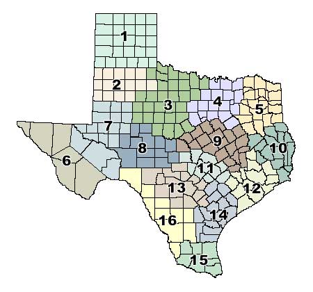
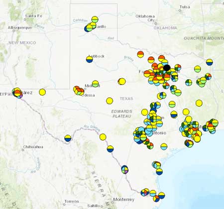
Interactive Regional Map
Information about TCEQ's air monitoring sites and the air pollution, weather and other parameters measured at each site, by region
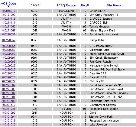
Air Monitoring Sites Table
View sortable list of locations and descriptions of monitoring sites operated by TCEQ and other entities around the state.
Link to photos of sites, parameters monitored, and current measurements.