Regional Haze: Overview
Overview of haze-forming pollution and the rule to reduce haze in national parks and wilderness areas.
Regional Haze Background
In many scenic areas of the country, air pollution can reduce visibility, or how far you can see. According to the EPA , the average visibility in eastern U.S. parks has decreased from 90 miles to 15—25 miles. In western U.S. parks, visibility has decreased from 140 miles to 35—90 miles.
Haze is the scattering and absorption of sunlight from particulate matter pollution in the air, which limits visibility. The particulate matter can come from human activity, like vehicles or electric generating facilities, and natural sources, like wind-blown dust and wildfires. Some haze-causing particles are emitted directly to the air, some are formed in the atmosphere, all can travel long distances by the wind. Some of the pollutants that form haze have been linked to health problems and environmental damage.
Regional Haze Rule
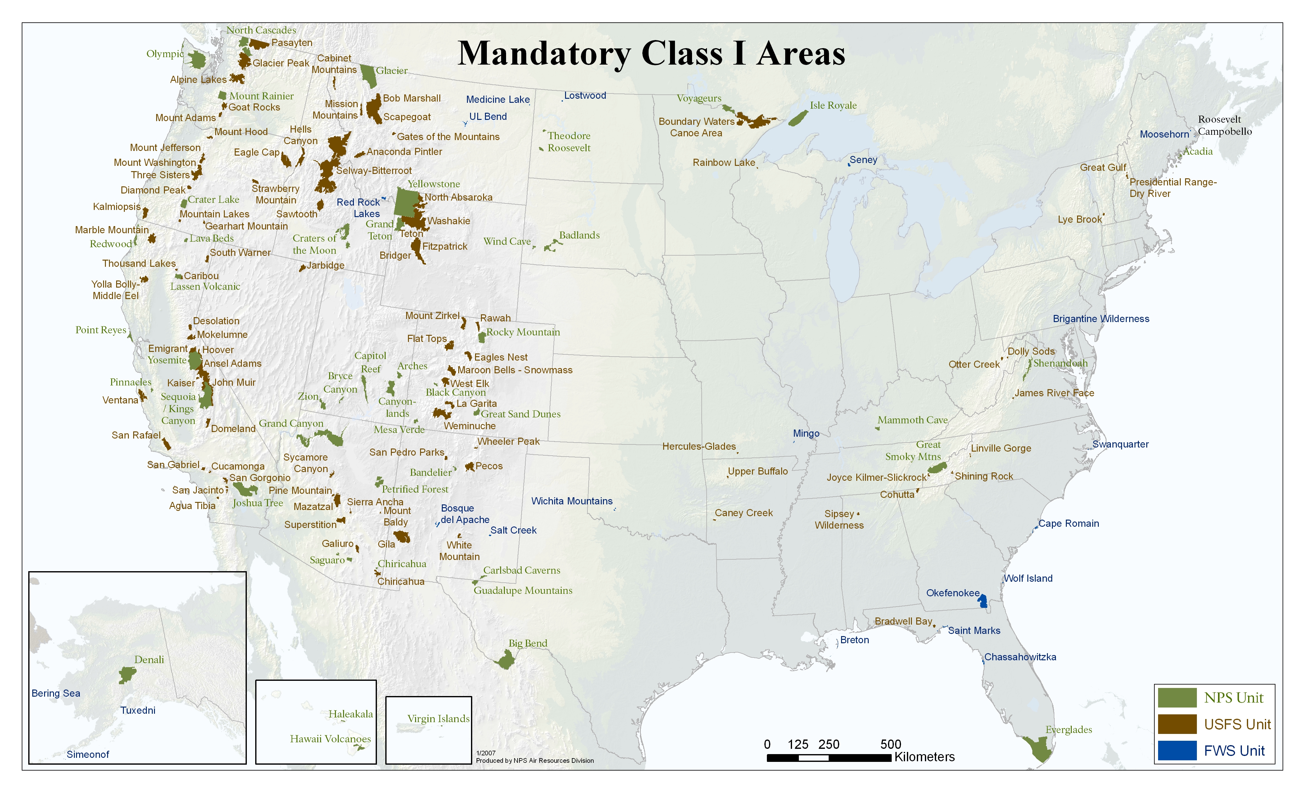
The Regional Haze Rule calls for state, tribal, and federal agencies to work together to improve visibility in the 156 national parks and wilderness areas , known as Class I areas, shown below.
State implementation plan (SIP) revisions to address Regional Haze Rule requirements are due in 2028 and every 10 years thereafter.
Image source: EPA.
Visibility in Texas National Parks
Texas has two Class I areas, Big Bend National Park and Guadalupe Mountains National Park in the western part of the state.
Big Bend National Park:
The National Parks Service operates the Big Bend National Park Continuous Air Monitoring System (CAMS)
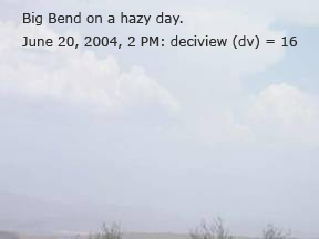
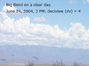
- Webcam views of Big Bend.
Click on 4 tabs below photo to see different views: today, clear/hazy, landmarks, and map of landmarks. Today’s tab gives visibility in miles, along with PM and ozone levels.
- Air Pollution & Visibility
- Park Air Profiles