Salado Creek: Dissolved Oxygen
This is a completed project to improve water quality by increasing dissolved oxygen in Salado Creek. The total maximum daily load was adopted. Although no Implementation Plan was developed and approved, stakeholders in the watershed are engaged in activities to improve dissolved oxygen levels and water quality in the creek.


County: Bexar
Parameter: Dissolved oxygen
Basin: San Antonio River
Segment: 1910
On this page:
Background and Goals
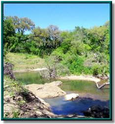
Salado Creek is a tributary of the San Antonio River in Bexar County. The upper portion is normally dry, flowing only after rains within the watershed. The lower portion has well-maintained parks and is an important recreational site for many people. Water-quality tests in the late 1990s showed that low concentrations of dissolved oxygen in Salado Creek were not optimal for the support of fish and other aquatic life. The goal of the project was to determine the cause of the low dissolved oxygen in Salado Creek in order to protect aquatic life.
While the amount of dissolved oxygen in water fluctuates naturally, various human activities can cause unusually or chronically low dissolved oxygen levels, which may harm fish and other aquatic organisms. In response to these conditions, a total maximum daily load (TMDL) project was initiated to determine the measures necessary to restore water quality in Salado Creek.
The goal of a TMDL is to determine the amount (or load) of a pollutant that a body of water can receive and still support its designated uses. This allowable load is allocated among all the controllable sources of pollution within the watershed. Measures to reduce pollutant loads are then developed as necessary.
Learn more about water quality standards, monitoring, and TMDLs by reading Preserving and Improving Water Quality.
Description of Watershed
Salado Creek is located in the upper portion of the San Antonio River Basin, with its headwaters in north central Bexar County. Salado Creek runs north to south for 35 miles along the north and east sides of the city of San Antonio, through the San Antonio International Airport and Fort Sam Houston. Salado Creek joins the San Antonio River south of the city between Losoya and Elmendorf.
The Salado Creek watershed covers 218 square miles. The upper portion of the watershed is largely undeveloped. The terrain is characterized by limestone hills and sparse vegetation typical of the Texas Hill Country. Dense urban development is located in the lower portion of the watershed. The upper portion of Salado Creek is normally dry except during rain events when it provides recharge to the Edwards Aquifer. Many people use the well-maintained parks along the lower reaches of the creek. Salado Creek is the most natural water course flowing through San Antonio.
Status
Project staff determined that there was additional capacity in Salado Creek to assimilate oxygen-demanding materials; therefore, an I-Plan for the TMDL is unnecessary.
Local organizations have taken action to preserve and enhance water quality in Salado Creek. Measures include the introduction of reused water to supplement the base flow in the stream, the rehabilitation of the sewage-collection system in the watershed, the establishment of additional park areas along the creek, public education, and continued water-quality monitoring.
In all its projects, TCEQ seeks to gather opinion and information from people who represent government, permitted facilities, agriculture, business, environmental, and community and private interests in the watershed. Participants in the Salado Creek Project include representatives of the following organizations:
- San Antonio River Authority
- San Antonio Water System
- San Antonio Health Department
- City of Karnes City
- Cibolo Creek Municipal Authority
- Southwestern Bell Telephone
- Union Stockyards
- Texas Commission on Environmental Quality
- Texas Parks and Wildlife Department
- Texas Railroad Commission
Keep up with the latest information about Salado Creek in the San Antonio River Authority’s Basin Reports .
Adopted TMDL
The commission approved the TMDL in October 2001. The EPA approved it on Aug. 8, 2003, at which time it became part of the state's Water Quality Management Plan.
-
One TMDL for Dissolved Oxygen in Salado Creek
Segment 1910 - Response to Public Comment on the Salado Creek TMDL
Contact Us
Please email tmdl@tceq.texas.gov and mention Salado Creek in the subject line. Or call us at 512-239-6682.