Lower Leon Creek: Fish Project


County: Bexar
Parameters: Polychlorinated biphenyls
Basin: San Antonio River
Segment: 1906
On this page:
Background and Goals
In 2002, the Texas Department of State Health Services (now the Department of State Health Services) issued an advisory restricting the consumption of all species of fish from Lower Leon Creek because concentrations of Polychlorinated Biphenyls (PCBs) in the tissues of fish posed a risk to consumers. The advisory covered the area of the creek from the State Highway 90 bridge downstream to the Interstate Loop 410 Bridge.
The term PCBs is used to describe 209 toxic and environmentally persistent compounds. Learn more about consumption advisories by visiting the Fishing Advisories and Bans page on the DSHS website .
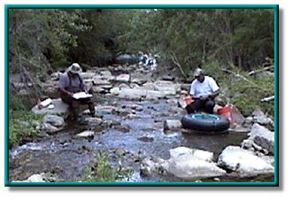
In response to this advisory, the Total Maximum Daily Load (TMDL) Program initiated a project to verify the extent of the fish consumption impairment in the creek.
Watershed Description
Lower Leon Creek (Segment 1906) drains an area of 228 square miles in Bexar County and has a total length of 57 miles. It originates as a spring-fed stream in the Edwards Plateau region of south-central Texas. The creek runs from its headwaters in northern Bexar County to its confluence with the Medina River. It generally flows south and enters the main portion of the former Kelly Air Force Base from the northwest, near the intersection of Billy Mitchell Road and Westover Road.
Leon Creek drains a highly urbanized residential area and the Kelly and Lackland Air Force bases. Water quality in Leon Creek is affected by industrial and municipal wastewater discharges and stormwater. The project watershed includes the cities of San Antonio, Cross Mountain, Helotes, and Leon Valley.
Texas DSHS still has a fishing advisory for Lower Leon Creek. Please take a moment to fill out this fish consumption survey to help DSHS better understand and serve the public with relevant information about advisories like this one.
Status
The DSHS collected and analyzed tissue from additional fish at five stations along Lower Leon Creek under an interagency agreement with TCEQ. Their analysis resulted in a new fish consumption advisory (ADV-42), which expanded the geographic extent of the original advisory (ADV-26).
Local interest in the fish consumption impairment also spurred a survey and characterization of PCBs in sediments. This survey was a collaborative effort of U.S. Geological Survey (USGS), San Antonio River Authority (SARA), and the City of San Antonio Metropolitan Health District Public Center for Environmental Health (CoSA MHD-PCEH). Monitoring at the former Kelly Air Force Base has also yielded PCB data.
The final report from USGS characterizing PCB levels in sediments from Lower Leon Creek and other streams in the San Antonio River basin was published in 2011.
- Assessment of Selected Contaminants in Streambed and Suspended-Sediment Samples Collected in Bexar County Texas, 2007–09, USGS Scientific Investigations Report 2011–5097
Public Participation
TCEQ staff worked with the Steering Committee of the San Antonio River Authority to keep the public informed of the status of fish tissue sampling activities. The Steering Committee is established under the Texas Clean Rivers Program.
Contact Us
For additional information regarding this assessment, email tmdl@tceq.texas.gov and mention the Lower Leon Creek fish tissue sampling project in the subject line. Or call us at 512-239-6682.