Dickinson Bayou: Recreational Uses
County: Galveston
Parameter: Bacteria
Basin: San Jacinto–Brazos Coastal
Segments: 1103, 1103A, 1103B, 1103C, 1103D, 1103E, 1104
On this page:
- Background and Goal
- Watershed Description
- Get Involved
- Approved I-Plan
- Adopted TMDLs
- Project Reports
- Contact Us
Background and Goal
High concentrations of bacteria measured in 2004 in Dickinson Bayou Tidal, Segment 1103, and four of its tributaries may pose a health risk for people who swim or wade water body—activities called “contact recreation” in the state’s standards for water quality.
Fecal bacteria are commonly found in the intestines of warm-blooded organisms such as humans, livestock, poultry, cats, and dogs. Bacteria from human and animal waste often indicate the presence of disease-causing microorganisms, which can pose a health threat to people who engage in contact recreation.
The goal of the total maximum daily load (TMDL) project is to reduce bacteria concentrations to within acceptable risk levels for contact recreation.
Watershed Description
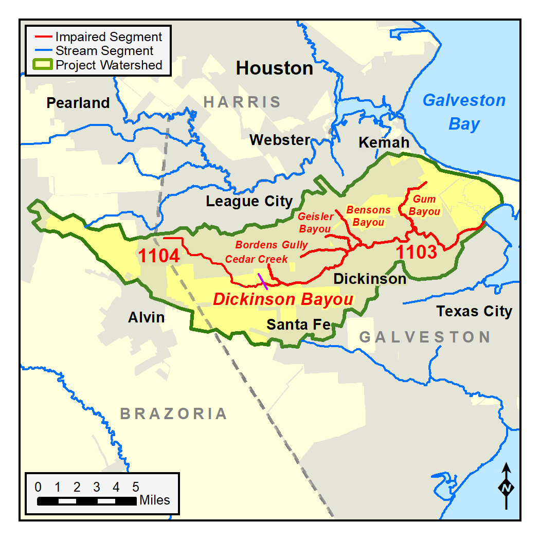
Dickinson Bayou is located in the San Jacinto-Brazos Coastal Basin. Its watershed includes portions of Brazoria and Galveston counties and the cities of Alvin, Santa Fe, Dickinson, and League City. The bayou originates near the city of Alvin, south of Houston, and flows east through the city of Dickinson before joining Dickinson Bay.
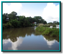
Upstream of the tidal influence, Dickinson Bayou (Segment 1104) is a small coastal prairie stream. The tidal segment (1103) ranges from a relatively narrow, forested stream in its upper reaches to a very wide and relatively deep tidal stream.
Dickinson Bayou is used by residents for recreational boating, fishing, water skiing, canoeing, and other activities. The lower tidal portions support some commercial shrimp harvesting and barge traffic. Rice fields in the upper watershed receive irrigation water via canals from beyond the watershed. The used irrigation water returns to Dickinson Bayou. Although the return flows contributed substantially to flow in the bayou in the past, rice farming has diminished significantly in the upper Dickinson watershed since the mid-1970s.
Get Involved
Stakeholders in the watershed formed the Dickinson Bayou Watershed Partnership to implement activities that improve water quality in Dickinson Bayou. The TCEQ worked with this existing forum to participate with the public in developing the TMDLs and I-Plan. Other partners include the Houston–Galveston Area Council, the Galveston Bay Estuary Program, and the Texas Cooperative Extension. Contact us about ways to get involved by e-mail at tmdl@tceq.texas.gov or by phone at 512-239-6682 and mention the Dickinson Bayou TMDL project.
Approved I-Plan
The commission approved this stakeholder-developed implementation plan (I-Plan) on Jan. 15, 2014.
Status and Activities
TCEQ provides opportunities for stakeholders to report on progress and changes in the watershed. Tracking of implementation progress allows stakeholders to evaluate actions taken, identify actions that may not be working, and make any changes as necessary.
The initial TMDL project addressed Dickinson Bayou Segments 1103 and 1104 and three of the bayou’s tributaries—Bensons Bayou, Bordens Gully, and Giesler Bayou.
In 2016, TCEQ added TMDLs for two tributaries, Gum Bayou and Cedar Creek, through an update to the State of Texas Water Quality Management Plan, along with an assessment unit of Dickinson Bayou Tidal that was not addressed in the initial TMDL report.
In 2022, TCEQ proposes to add two more TMDLs for the bayou's watershed, for unnamed tributaries of Dickson Bayou Tidal and Gum Bayou, via an update to the State of Texas Water Quality Management Plan
Adopted TMDLs
On Feb. 8, 2012, the commission adopted these TMDLs. On June 6, 2012, EPA approved the TMDLs, at which time they became part of the state’s Water Quality Management Plan. Learn more about the Texas Water Quality Management Plan.
-
Eight for Indicator Bacteria in Dickinson Bayou and Three Tidal Tributaries TMDLs
Segments: 1103, 1103A, 1103B, 1103C, and 1104; Assessment Units: 1103_02, 1103_03, 1103_04, 1103A_01, 1103B_01, 1103C_01, 1104_01, and 1104_02 - Response to Public Comment on the TMDLs
Revisions to TMDLs
From time to time, it is necessary to revise TMDLs to account for changing conditions in the watershed. Revisions to TMDLs are made via the state’s Water Quality Management Plan (WQMP), which is updated quarterly.
The WQMP provides projected effluent limits for use in planning and permitting activities under the Texas Pollutant Discharge Elimination System (TPDES). The TCEQ reviews all applications for new and amended permits for conformance with applicable portions of the WQMP, including adopted TMDLs.
Revisions are made to TMDLs in one of two ways:
- Updates are made to account for changing conditions in the watershed, such as new or revised wasteload allocations, permits that have been canceled or have expired, or changed facility names.
- Addenda are created to add load allocations for assessment units that are impaired by the same pollutant or condition, within the same watershed, as in the original TMDL report adopted by the commission.
Both updates and addenda are provided in the same units of measure used in the original TMDL.
Addenda
Additional TMDLs for Dickinson Bayou have been added by addendum.
-
TMDL Addendum One: Three TMDLs for Bacteria in Dickinson Bayou
Segments: 1103, 1103D, and 1103E; Assessment Units: 1103_01, 1103D_01, and 1103E_01
Added via the July 2016 WQMP Update. Approved by EPA September 30, 2016 -
TMDL Addendum Two: Two TMDLs for Bacteria in Dickinson Bayou
Segments: 1103F, 1103G; Assessment Units: 1103F_01 and 1103G_01
Added via the April 2022 WQMP Update. Approved by EPA August 11, 2022
Updates
Revisions to the TMDL are documented an appendix in the approved WQMP update listed below.
- October 2021, Appendix II, pages 18-19
- April 2016, Appendix IV, pages 15-16
WQMP updates may be viewed in person at the TCEQ Library, Building A, 12100 Park 35 Circle, Austin, Texas. Electronic versions of updates published from 2014 through 2020 are available on the Texas State Library and Archives Commission website .
Project Reports
- Technical Support Document, 2022, TMDL Amendment 2, two TMDLs
- Technical Support Document, 2014, TMDL Amendment 1, three TMDLs
- Technical Support Document, 2012, original TMDLs
Contact Us
Please e-mail tmdl@tceq.texas.gov, and mention Dickinson Bayou in the subject line. Or call us at 512-239-6682.


 Back to top