Adams Bayou and Cow Bayou Watersheds
Counties: Orange, Jasper, Newton
Parameters: Bacteria, dissolved oxygen, pH
River Basin: Sabine River
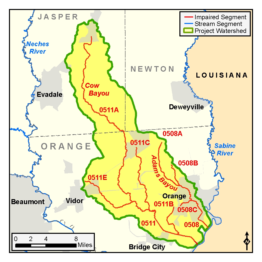
Segments: 0508, 0508B, 0508C, 0511, 0511A, 0511B, 0511C, 0511E
Assessment Units (AUs): 0508_01, 0508_02, 0508_03, 0508_04, 0508B_01, 0508C_01, 0511_01, 0511_02, 0511_03, 0511_04, 0511A_02, 0511B_01, 0511C_01, 0511E_01
On this page:
- Project Description and Goals
- Watershed Description
- Get Involved
- Status
- Approved I-Plan
- Adopted TMDLs
- Reports and Other Documents
- Contact Us
Project Description and Goals
Between 1992 and 2002, TCEQ found that bacteria levels in the bayous and their tributaries may pose a health risk for people who swim or wade in the water bodies—activities called “contact recreation” in the state’s standards for surface water quality. Certain types of fecal bacteria from both human and animal waste may indicate the presence of disease-causing microorganisms that could cause gastro-intestinal illness in people who swallow natural waters.
Low concentrations of dissolved oxygen in some areas indicate that conditions are not optimal for aquatic life. Oxygen, which dissolves in water, is essential for the survival of aquatic life. While the amount of dissolved oxygen in water fluctuates naturally, various human activities can cause unusually or chronically low dissolved oxygen levels.
Furthermore, in Cow Bayou, pH values were occasionally lower than criteria established to protect general uses.
In 2002, TCEQ launched a project to develop TMDLs for the watershed to determine the amount (or load) of a pollutant that a water body can receive and still meet applicable water quality standards. The goals of the project are to:
- reduce bacteria levels in the bayous to ensure that recreational use is safe, and
- maintain levels of dissolved oxygen and pH that will sustain aquatic life.
The Sabine River Authority and other stakeholders worked with TCEQ to develop the plan for improving water quality in the project watershed.
Watershed Description
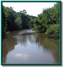
Adams Bayou and Cow Bayou are located in southeast Texas. Their combined watersheds cover almost 250 square miles in the coastal area of the Sabine River Basin. Water flow in the bayous is intermittent, and periods with no flow are very common. The topography of the region is relatively flat. The natural landscape is characterized by a heavy clay substrate and a mix of pine and deciduous trees.
The lower portion of the Adams Bayou watershed is urban, and includes most of the cities of Orange, West Orange, and Pinehurst. A tidally influenced tributary to Adams Bayou, Hudson Gully, flows through the heart of this urban area. The lower portion of Adams Bayou has been dredged and channelized for navigation. Hudson Gully and a freshwater tributary to Adams Bayou, Gum Gully, have been channelized to improve drainage in the watershed.
The Cow Bayou watershed is urban in some areas, and includes portions of the cities of Buna, Mauriceville, Vidor, and Bridge City. Large areas of the watershed are used for agriculture, including rangeland/pasture and hay production. Three of Cow Bayou's tributaries, Cole Creek, Terry Gully, and Coon Bayou, were also impaired. The lower portion of Cow Bayou has been dredged and channelized for navigation. Like Adams Bayou, several of its tributaries have been channelized for drainage.
Both Adams Bayou and Cow Bayou watersheds are affected by municipal and industrial wastewater discharges and by storm water runoff from agricultural, industrial, and urban areas.
Get Involved
In all its projects, TCEQ gathers opinions and information from a variety of people with interest in the watershed. The Sabine River Authority , in partnership with TCEQ, coordinates efforts to implement the I-Plan and improve water quality in Adams and Cow bayous. Read more about what it means to Participate in TMDL Projects.
Approved I-Plan
A TMDL I-Plan outlines the measures needed to reduce pollutant loads through regulatory and voluntary activities. Community stakeholders worked together to create the I-Plan. On Aug. 5, 2015, the Commission approved the stakeholders' plan.
- I-Plan for 17 TMDLs for Bacteria, Dissolved Oxygen, and pH in Adams Bayou, Cow Bayou, and Their Tributaries
- Response to Public Comments on the I-Plan
Since January 2021, TCEQ and Sabine River Authority have been collecting information for a possible update to the 2015 I-Plan.
Status
The Sabine River Authority and TCEQ hold regular public meetings to review progress of implementing the TMDLs and to get ideas and feedback about how to improve the I-Plan. Tracking of implementation progress allows stakeholders to evaluate actions taken, identify actions that may not be working, and make any changes as necessary.
- Year 5 Status, June 2021
- Year 4 Status, September 2019
- Year 1 Status, September 2016
Adopted TMDLs
TCEQ originally adopted 17 TMDLs in 2007 for bacteria, dissolved oxygen, and pH for the watersheds associated with this project. In 2020, based on new data, TCEQ revised and adopted 23 TMDLs in place of the original 17. Stakeholders advised TCEQ on the development of both the original and the revised TMDLs.
Revised TMDLs
The Commission adopted the revised TMDLs on Aug. 26, 2020. EPA approved them on Oct. 9, 2020, at which time they became part of the state's Water Quality Management Plan.
-
23 TMDLs for Indicator Bacteria, Dissolved Oxygen, and pH in Adams Bayou, Cow Bayou, and Associated Tributaries
AUs 0508_01, 0508_02, 0508_03, 0508_04, 0508B_01, 0508C_01, 0511_01, 0511_02, 0511_03, 0511_04, 0511A_02, 0511B_01, 0511C_01, 0511E_01 - Response to Public Comment on the Revised TMDLs for Adams and Cow Bayous and Tributaries
Original TMDLs
The Commission adopted these TMDLs on June 13, 2007. EPA approved them on Aug. 28, 2007, at which time they became part of the state's Water Quality Management Plan (WQMP).
-
17 TMDLs for Bacteria, Dissolved Oxygen, and pH in Adams Bayou, Cow Bayou, and Their Tributaries
Segments: 0508, 0508A, 0508B, 0508C, 0511, 0511A, 0511B, 0511C, and 0511E. - Response to Public Comment on the TMDLs for Adams and Cow Bayous and Tributaries
Revisions to TMDLs
From time to time, it is necessary to revise TMDLs to account for changing conditions in the watershed. Revisions to the load allocations in TMDLs are made via the state’s Water Quality Management Plan (WQMP), which is updated quarterly.
The WQMP provides projected effluent limits for use in planning and permitting activities under the Texas Pollutant Discharge Elimination System (TPDES). The TCEQ reviews all applications for new and amended permits for conformance with applicable portions of the WQMP, including adopted TMDLs.
Updates
Updates are made to account for changing conditions in the watershed, such as new or revised wasteload allocations, permits that have been canceled or have expired, or changed facility names. Updates use the same units of measure as the original TMDL.
- July 2008, pages 7-9
WQMP updates may be viewed in person at the TCEQ Library, Building A, 12100 Park 35 Circle, Austin, Texas. Electronic versions of updates published from 2014 through the present are available on the Texas State Library and Archives Commission website .
For WQMP updates prior to 2014, use the TRAIL Search the TCEQ engine as outlined below. The main search box on the page will only conduct a simple search with no exclusionary parameters and should not be used.
- First, limit your search to TCEQ only. Do this via the advanced search feature on the left of the page. To limit a search to TCEQ content, enter “www.tceq.texas.gov” or “www.tceq.state.tx.us” into the “From the Host” search box.
- Refine your search to narrow down results. The other search boxes on the left of the page allow for search terms to be included, excluded, or used in an exact phrase search. Date ranges can be used as well.
Reports and Other Documents
- Technical Support Document – Bacteria TMDL Revisions, April 2020
- Technical Support Document – Dissolved Oxygen and pH TMDL Revisions, March 2020
- Technical Support Document – Watershed Model, January 2006
- Technical Support Document – Water Quality Model, September 2006
Contact Us
Please email tmdl@tceq.texas.gov and mention the Adams Bayou and Cow Bayou project in the subject line. Or call us at 512-239-6682.


 Back to top