Neches River Tidal

Counties: Jefferson, Orange
Parameter: Bacteria
Basin: Neches River
Segment: 0601
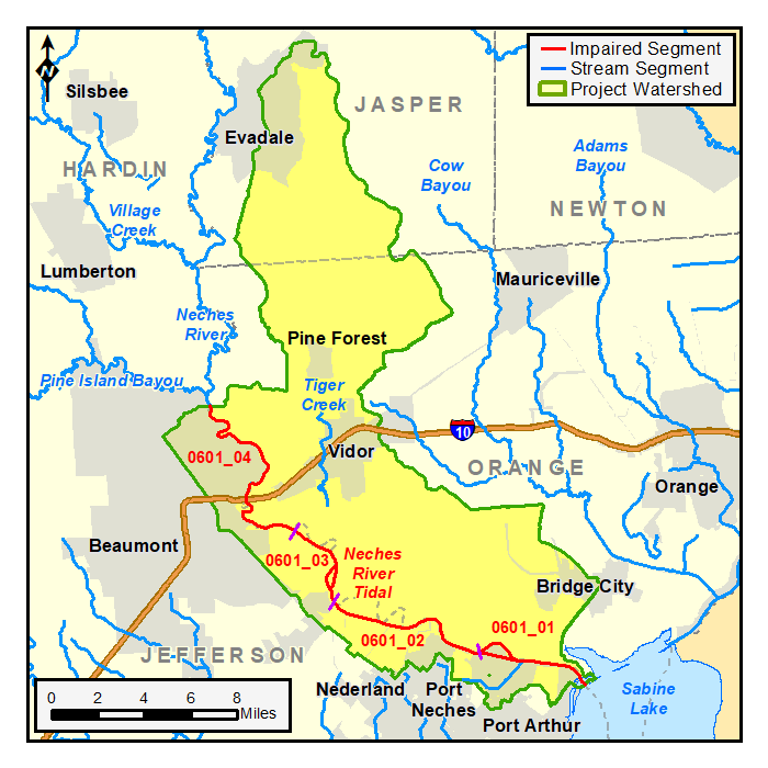
Assessment Units (AUs): 0601_01, 0601_02, 0601_03, and 0601_04
On this page:
- Background and Goals
- Watershed Description
- Get Involved
- Approved I-Plan
- Adopted TMDL
- Reports
- Contact Us
Background and Goals
The Neches River Tidal watershed lies in the gulf coast region of east Texas in the Neches River Basin. The watershed includes portions of Jefferson and Orange counties. Beaumont, Vidor, and Port Neches are some of the cities in the watershed.
High concentrations of bacteria, which are found in both human and animal waste, have been observed in the Neches River Tidal portion of the river (Segment 0601). The presence of these bacteria may indicate a health risk to people who swim or wade in the river—activities referred to as “contact recreation” in the Texas Surface Water Quality Standards.
The goal of this project is to improve water quality in order to protect recreational uses. Toward that goal, the TCEQ and stakeholders developed total maximum daily loads (TMDLs) to reduce bacteria in Neches River Tidal and a coordinated implementation plan (I-Plan) for the Neches River Tidal and Hillebrandt Bayou watersheds.
Watershed Description
The watershed lies in the gulf coast region of east Texas in the Neches River Basin. The Neches River Tidal is a 27-mile tidal stream that flows from the confluence with Sabine Lake in Orange County to the Neches River Saltwater Barrier, about one-half mile downstream of the confluence of Pine Island Bayou in Orange County. The Neches River Tidal segment consists of four stream assessment units. All four AUs are impaired for the contact recreation use due to elevated levels of indicator bacteria.
The Neches River Tidal watershed is about 211 square miles. The dominant land cover includes woody wetlands (24%), developed (20%), forest (17%), and open water (12%). The cities of Beaumont, Vidor, and Port Neches are located in the watershed, which includes portions of Jefferson and Orange counties.
Get Involved
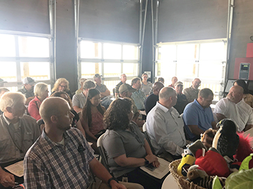
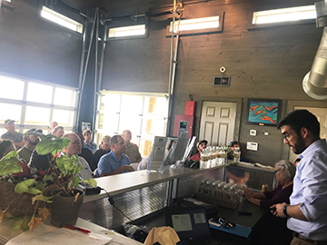
Staff from the Texas Water Resources Institute (TWRI) are working with communities, interest groups, and local organizations to distribute information about this project and involve stakeholders in implementing the I-Plan for watershed improvement. All public meetings about this project are open to anyone interested. Watch for meeting announcements here and on the TWRI website .
Meeting Records
May 17, 2021
Aug. 19, 2020
Aug. 14, 2020
- Meeting Summary
- Presentation: Technical Support Documents for Hillebrandt Bayou and Neches River Tidal
April 9, 2020
- Meeting Summary
- Presentation: Water Quality Planning for Neches River Tidal and Hillebrandt Bayou
- Presentation: Hillebrandt Bayou Technical Support Document
Aug. 22, 2019
- Meeting Summary
- Presentation: Water Quality Planning and Implementation in Texas
- Presentation: Hillebrandt Bayou And Neches Tidal Project Update
- Presentation: TMDL Implementation In Texas
Approved I-Plan
Community stakeholders worked with TCEQ and TWRI to create the draft I-Plan below. The I-Plan was approved in August 2023.
- I-Plan for Five TMDLs for Indicator Bacteria in Hillebrandt Bayou and Neches River Tidal
-
Response to Public Comment on Hillebrandt Bayou and Neches River Tidal I-Plan
Status of Activities
TCEQ provides opportunities for stakeholders to report on progress and changes in the watershed. Tracking of implementation progress allows stakeholders to evaluate actions taken, identify actions that may not be working, and make any changes as necessary.
- Hillebrandt Bayou and Neches River Tidal: TMDL Implementation Status Year 1, October 2024
- Hillebrandt Bayou & Neches River Tidal: TMDL Implementation Status Year Two, July 2025
Adopted TMDLs
Community stakeholders worked with the TCEQ to develop the TMDL. On July 19, 2023, the Commission adopted the TMDL for bacteria in Neches River Tidal. EPA approved these TMDLs on Oct. 11, 2023, at which time they became an update to the state's Water Quality Management Plan.
- Four TMDLs for Indicator Bacteria in Neches River Tidal
- Response to Preliminary EPA Comment (no EPA comments were received)
- Response to Comment
Reports
Contact Us
Please email tmdl@tceq.texas.gov, and mention the Neches River Tidal bacteria project in the subject line. Or call us at 512-239-6682.