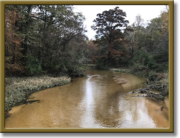
Sandy and Wolf Creeks
Counties: Jasper, Tyler
Parameter: Bacteria
Basin: Neches River
Segment: 0603A, 0603B
Assessment Units (AUs): 0603A_01, 0603B_01
On this page:
- Background and Goals
- Watershed Description
- Get Involved
- Adopted I-Plan
- Adopted TMDLs
- Reports
- Contact the TMDL Program
Background and Goals
High concentrations of bacteria have been observed in Sandy Creek (Segment 0603A, AU 0603A_01) and Wolf Creek (Segment 0603B, AU 0603B_01). The presence of these bacteria may indicate a health risk to people who swim or wade in the creeks—activities referred to as “contact recreation” in the Texas Surface Water Quality Standards.
To address these concerns, people who have a stake in the watershed are working with TCEQ to develop a TMDL and a plan to implement it (I-Plan). A TMDL is like a budget—it determines the amount (or load) of bacteria that the bayou can receive and still support recreational safety. The allowable load is then allocated among categories of sources within the watershed. The I-Plan outlines the measures that will be used to reduce pollution.
The goal of this project is to improve water quality to protect recreational uses.
Watershed Description
Sandy and Wolf creeks are tributaries to B. A. Steinhagen Lake. The watersheds lie in east Texas about sixty miles north of the city of Beaumont in the gulf coast region of east Texas in the Neches River Basin and include the cities of Colmesneil in Tyler County and Jasper in Jasper County. Wolf Creek flows east before emptying into B.A. Steinhagen Lake. Sandy Creek flows southwest through Jasper before emptying into the lake.
This project includes two stream segments:
- Sandy Creek in Jasper County -Segment 0603A
From the confluence of B.A. Steinhagen Lake southwest of City of Jasper in Jasper County to the confluence of Big and Little Sandy Creeks in City of Jasper in Jasper County. - Wolf Creek - Segment 0603B
From the confluence of B. A. Steinhagen Lake southeast of Colmesneil in Tyler County to the upstream perennial portion of the stream south of Colmesneil in Tyler County.
The Sandy Creek watershed is about 57 square miles. The dominant land cover includes forest (45%), shrub/scrub (13%), and developed (15%). Jasper is the largest city in the watershed, with a population of 7,584 in 2018.
The Wolf Creek watershed is about 83 square miles. The dominant land cover includes forest (50%) and grassland/herbaceous (14%). Colmesneil is the only town in the watershed, with a population of 590 in 2018.
Get Involved
Staff from the Texas Water Resources Institute have been working with communities, interest groups, and local organizations to distribute information about this project and involve stakeholders in developing the I-Plan for watershed improvement. All public meetings about this project are open to anyone interested. Watch for meeting announcements here and on TWRI's Meetings webpage , which includes all the meetings TWRI hosts for TMDL projects in the Neches River Basin.
Meeting Records
Records for some of the stakeholder meetings are available below. Records of other meetings are available on TWRI's Meetings webpage , which includes all the meetings TWRI hosts for TMDL projects in the Neches River Basin.
- May 17, 2021
- Sept. 1, 2020
- Nov. 21, 2019
Adopted I-Plan
Community stakeholders worked together to create the I-Plan. The Commission approved the stakeholders' plan on June 14, 2023.
- I-Plan for Two TMDLs for Indicator Bacteria in Sandy Creek and Wolf Creek
- Response to Public Comment: I-Plan for Sandy Creek and Wolf Creek (no comments received)
Status of Activities
TCEQ provides opportunities for stakeholders to report on progress and changes in the watershed. Tracking of implementation progress allows stakeholders to evaluate actions taken, identify actions that may not be working, and make any changes as necessary.
- Year One Implementation Status Update, June 2023
- Year Two Implementation Status Update, September 2024
- Year Three Implementation Status Update, July 2025
Adopted TMDLs
The Commission adopted these TMDLs on May 18, 2022. On Aug. 18, 2022, EPA approved the TMDLs, at which time they became part of the state’s Water Quality Management Plan. Learn more about the Texas Water Quality Management Program.
Reports
- Technical Support Document, Revised June 2020
- TWRI's Summer 2020 Project Newsletter
Contact the TMDL Program
Please email tmdl@tceq.texas.gov and mention Sandy and Wolf creeks in the subject line. Or call us at 512-239-6682.


 Back to top