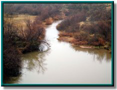
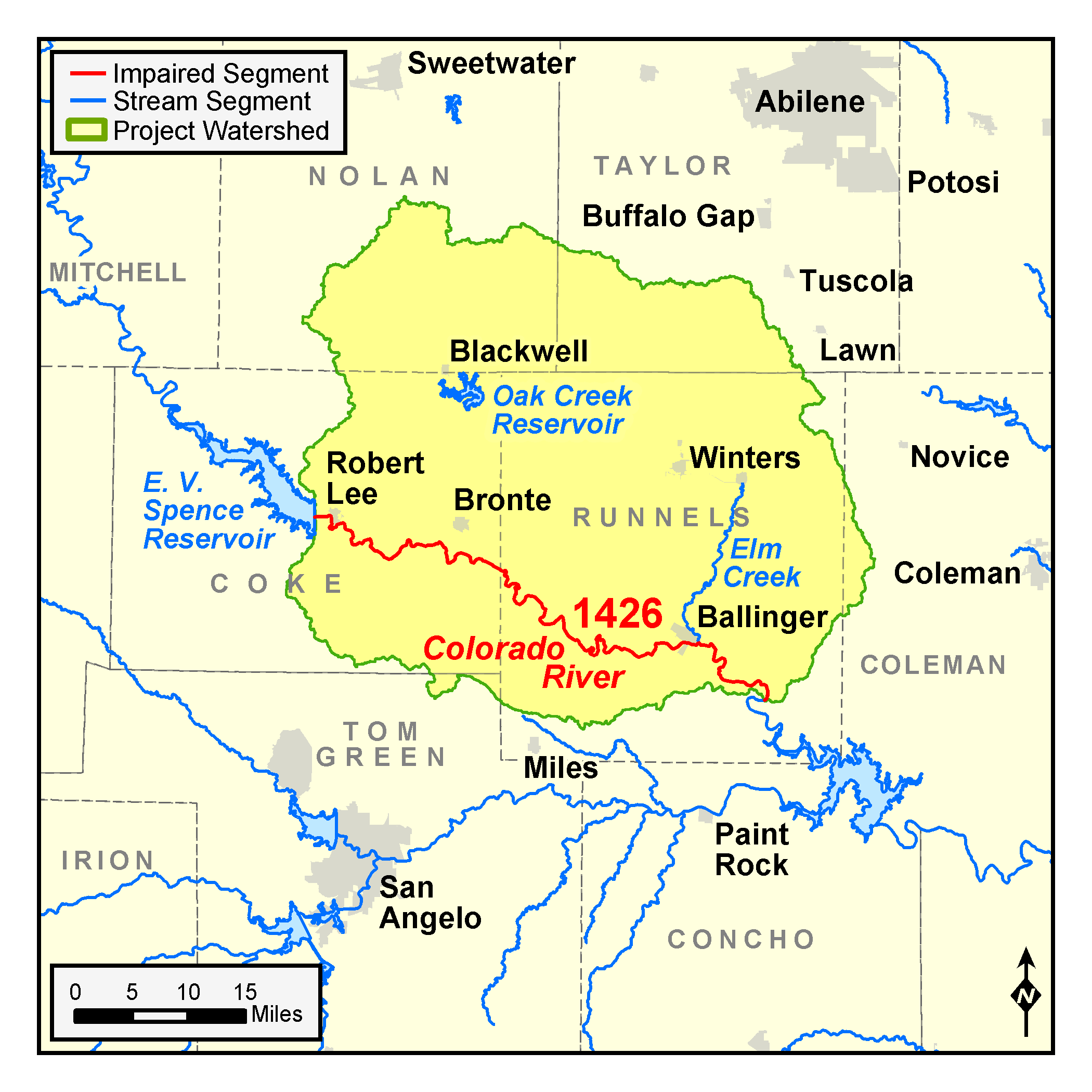
Colorado River Below E.V. Spence Reservoir
Counties: Coke, Runnels, Nolan, Taylor
Parameters: Chloride, Sulfate, TDS
River Basin: Colorado River
Segment: 1426
On this page:
- Background and Goal
- Watershed Description
- Public Participation
- Approved I-Plan
- Adopted TMDLs
- Reports
- Contact the TMDL Program
Background and Goal
In 2000, water quality testing found elevated levels of chloride, sulfate, and total dissolved solids (TDS) in the Colorado River Below E.V. Spence Reservoir. High concentrations of these salts are indicators of general water quality that are not tied to a specific use, but may affect several uses.
For example, too much chloride can cause a bad taste in drinking water, harm plumbing, and increase the risk of hypertension in humans. Large quantities of sulfate can cause drinking water to smell or taste bad. High concentrations of dissolved solids can be toxic to species that live in fresh water.
The goal of this project was to improve water quality in the river by developing and implementing TMDLs.
TCEQ contracted with EA Engineering, Science, and Technology to study the segment and develop TMDLs. EA Engineering collected additional data under a range of stream flow conditions, including wet weather, and accounted for direct discharges from point sources, such as wastewater treatment plants, and runoff from nonpoint sources, such as agricultural operations, land-clearing activities, abandoned oil and gas wells, and carbonate dissolution.
In June 2004, the Bureau of Economic Geology (BEG) surveyed electromagnetic conductivity in and around the creek. Their survey supported the groundwater component of models used to develop the TMDLs.
Based on analysis of these studies and other information gathered during the investigation, the stakeholders and TCEQ developed TMDLs and an I-Plan for the watershed. TCEQ adopted the TMDLs in February 2007 and approved the stakeholders’ I-Plan on Oct. 10, 2007.
Watershed Description
The Colorado River Below E.V. Spence Reservoir, Segment 1426, is a 66-mile freshwater stream located within the Colorado River Basin. Segment 1426 receives the majority of its flow from E.V. Spence Reservoir. It begins at Robert Lee Dam and flows south-easterly through Coke and Runnels Counties, ending 2.3 miles below its confluence with Mustang Creek in Runnels County.
The Edwards-Trinity aquifer is the principal source of groundwater in the watershed. The Edwards-Trinity is composed of sandstone and carbonate-rock aquifers and encompasses an area of 818 square miles. Most of the land is well adapted to cultivation. The land use and economy are chiefly agricultural, with land devoted to both crop and animal production. Oil and gas production and exploration are the dominant industrial activities in the watershed. Mineral resources include brick-making clay in addition to oil and gas deposits.
Public Participation
People who live or work in the watershed, or stakeholders, worked closely with the TCEQ and the Upper Colorado River Authority on the TMDLs and I-Plan to improve the creek.
Approved I-Plan
The commission approved the I-Plan on Oct. 10, 2007.
- I-Plan for Two TMDLs for Chloride and Total Dissolved Solids, Colorado River Below E. V. Spence Reservoir, Segment 1426
- Response to Public Comment on the I-Plan
Revised I-Plan
In 2013, the Upper Colorado River Authority (UCRA) began working with stakeholders to review the I-Plan and its progress. Through a series of public meetings, UCRA worked closely with stakeholders to gather information and form a coordination committee and work groups to focus on specific aspects of the plan. In 2014, the stakeholders prepared a revised I-Plan to continue their efforts in improving local water quality.
- 2014 Update to the I-Plan for the Colorado River Below E.V. Spence Reservoir
Status of Restoration
Segment 1426 was removed from the index of all impaired waters in the 2020 Texas Integrated Report of Water Quality. Based on data collected Dec. 1, 2011 through Nov. 30, 2018, concentrations of dissolved solids in the river segment are now within the criteria in the Texas Surface Water Quality Standards. The TMDLs remain in effect.
The stakeholders met in May 2016 to discuss progress on their I-Plan, which was revised in 2014. Tracking implementation progress allows stakeholders to evaluate actions taken, identify actions that may not be working, and make any changes as necessary.
Adopted TMDLs
The commission adopted two TMDLs for the Colorado River on Feb. 7, 2007.
-
Two TMDLs for Chloride and Total Dissolved Solids, Colorado River Below E. V. Spence Reservoir
Segment 1426 - Response to Public Comment on the TMDLs
The EPA approved the TMDLs on April 9, 2007, at which time they became part of the state’s Water Quality Management Plan.
Revisions to TMDLs
From time to time, it is necessary to revise TMDLs to account for changing conditions in the watershed. Revisions to the load allocations in TMDLs are made via the state’s Water Quality Management Plan (WQMP), which is updated quarterly.
The WQMP provides projected effluent limits for use in planning and permitting activities under the Texas Pollutant Discharge Elimination System (TPDES). The TCEQ reviews all applications for new and amended permits for conformance with applicable portions of the WQMP, including adopted TMDLs.
Updates
Updates are made to account for changing conditions in the watershed, such as new or revised wasteload allocations, permits that have been canceled or have expired, or changed facility names. Updates use the same units of measure as the original TMDL.
- July 2009, Appendix II, pages 8-9
- January 2010, Appendix I, pages 10-11
WQMP updates may be viewed in person at the TCEQ Library, Building A, 12100 Park 35 Circle, Austin, Texas. Electronic versions of updates published from 2014 through the present are available on the Texas State Library and Archives Commission website .
For WQMP updates prior to 2014, use the TRAIL Search the TCEQ engine as outlined below. The main search box on the page will only conduct a simple search with no exclusionary parameters and should not be used.
- First, limit your search to TCEQ only. Do this via the advanced search feature on the left of the page. To limit a search to TCEQ content, enter “www.tceq.texas.gov” or “www.tceq.state.tx.us” into the “From the Host” search box.
- Refine your search to narrow down results. The other search boxes on the left of the page allow for search terms to be included, excluded, or used in an exact phrase search. Date ranges can be used as well.
Reports
- Electromagnetic Conductivity Surveys: Final Technical Report
Contact the TMDL Program
Please e-mail tmdl@tceq.texas.gov and mention the Colorado River Below Spence TMDL project in the subject line. Or call us at 512-239-6682.


 Back to top